|
search place name
|
||
Gandembel (Guinea-Bissau)Gandembel is a town in Guinea-Bissau. An overview map of the region around Gandembel is displayed below.
regional and 3d topo map of Gandembel, Guinea-Bissau ::

Gandembel airports ::
The nearest airport is BXO - Bissau Oswaldo Vieira Intl, located 109.9 km north west of Gandembel.
Other airports nearby include FIG - Fira Fria (175.3 km south east), ZIG - Ziguinchor (208.2 km north west), CSK - Cap Skiring (241.4 km north west), BJL - Banjul Intl (296.9 km north west), Nearby towns ::
Sare Mórsô (1.8km east) //
Bomane (2.6km south west) //
Madina (3.7km south) //
Paroldade (5.2km south west) //
Sinchuro (5.5km west) //
Uali Sachà (5.8km west) //
Bancobunje (6.6km north west) //
Unsirè (6.6km south west) //
Famora (8.2km north west) //
Guileje (8.2km south west) //
Fafaje (9.2km north west) //
[all distances 'as the bird flies' and approximate] 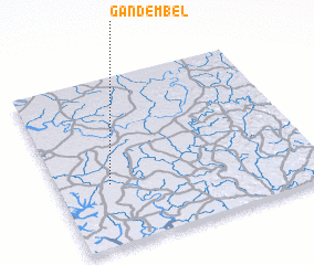 Places with similar names to Gandembel, Guinea-Bissau ::
// Kandamal (PH)
// Kent Mill (US)
// Candemil (PT)
// Candemil (PT)
// Contumil (PT)
// Gontomil (PT)
// Candamil (ES)
// Candemuela (ES)
// Quindimil (ES)
// Kennedy Mill (US)
Disclaimer :: Information on this page comes without warranty of any kind |
||
|
Where is Gandembel? Elevation and coordinates ::
Latitude (lat): 11°22'0"N Longitude (lon): 14°48'0"W
Elevation (approx.): 43m (map arrows pan, magnifying glasses zoom) |
||
|
Visiting Gandembel? Hotel/Accommodation ::
Book a hotel in Gandembel Travel Guide ::
rental cars ::
car rental offers GPS waypoint ::
download a GPX waypoint (PoI) of Gandembel for your GPS receiver
|
||