|
search place name
|
||
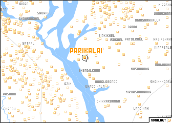
Pāri Kalai (North-West Frontier, Pakistan)Pāri Kalai is a town in the North-West Frontier region of Pakistan. An overview map of the region around Pāri Kalai is displayed below.
regional and 3d topo map of Pāri Kalai, Pakistan ::
Pāri Kalai airports ::
The nearest airport is PEW - Peshawar Intl, located 141.1 km north east of Pāri Kalai.
Other airports nearby include JAA - Jalalabad (175.4 km north), PZH - Zhob (211.1 km south west), KBL - Kabul Intl (244.1 km north west), SDT - Saidu Sharif (258.3 km north east), Nearby towns ::
Mīr Khawāza (0.8km north) //
Mākhān Bānda (1.5km north) //
Akhundān Bānda (1.4km west) //
Mīr Hassan (2.2km north west) //
Bānda Aurang (2.3km north) //
Bānda Ali Khān (2.2km north east) //
Bānda Zaid Gul (2.2km east) //
Bānda Mīr Khawāja (2.4km north east) //
Sherdil Khān (2.9km south) //
Malla Khel (3.3km south) //
Michan Khel (3.4km east) //
Maghāra Akram Khān (3.9km south) //
Bandar Kalai (4.0km north east) //
Kamar Dīn (4.9km north) //
Meh Shāh Khel (4.6km south west) //
Rāibat (5.2km north east) //
Shakhāl Khel (5.0km south west) //
Nār Haidarān (4.7km west) //
Bānda Pāi (5.2km north east) //
Shodi (5.6km north east) //
Shāhmadu Dau Khel (5.3km south west) //
Bodāk (6.1km north) //
Saiyid Khān Sharīf Khel (5.6km south west) //
Abdulla Khān (5.9km south west) //
Sirki Khel (6.1km north east) //
Dhaddīwāla (6.6km south) //
Mīr Akbar Kalla (6.6km north) //
Khāna Woz (6.7km north) //
Mangla Bānda (6.5km south east) //
[all distances 'as the bird flies' and approximate] 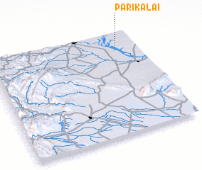 Places with similar names to Pāri Kalai, Pakistan ::
Disclaimer :: Information on this page comes without warranty of any kind |
||
|
Where is Pāri Kalai? Elevation and coordinates ::
Latitude (lat): 32°50'51"N Longitude (lon): 70°51'27"E
Elevation (approx.): 304m (map arrows pan, magnifying glasses zoom) |
||
|
Visiting Pāri Kalai? Hotel/Accommodation ::
Book a hotel in Pāri Kalai Travel Guide ::
Buy a travel guide for Pakistan rental cars ::
car rental offers GPS waypoint ::
download a GPX waypoint (PoI) of Pāri Kalai for your GPS receiver
|
||