|
search place name
|
||
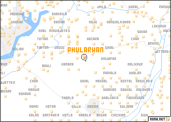
Phularwān (Punjab, Pakistan)Phularwān is a town in the Punjab region of Pakistan. An overview map of the region around Phularwān is displayed below.
regional and 3d topo map of Phularwān, Pakistan ::
Phularwān airports ::
The nearest airport is IXJ - Jammu, located 92.4 km east of Phularwān.
Other airports nearby include RAZ - Rawala Kot Rawalakot (105.6 km north), ISB - Islamabad Chaklala (108.0 km north west), SXR - Srinagar (146.3 km north east), ATQ - Amritsar (157.6 km south east), Nearby towns ::
Balim (1.6km north) //
Kund (1.9km north) //
Dandi Lohāri (1.7km west) //
Marira (2.0km north east) //
Pind Azīz (2.3km south west) //
Dandi Nizām (2.4km north west) //
Besa (2.4km north east) //
Shāh Kuliān (2.6km north) //
Dara (2.7km north west) //
Ban Barila (3.1km south east) //
Besa Jattu (3.2km north east) //
Pothi (4.0km north west) //
Hazāra (4.0km north east) //
Dandi Maliār (3.6km north west) //
Kanāra (3.6km south west) //
Maira (3.7km south east) //
Pothi (4.6km north) //
Dāk (4.8km north west) //
Baroth (4.8km south east) //
Balobaniān (4.8km north east) //
Pīr Jāfar (4.5km east) //
Chanan (4.7km north west) //
Dhok Pothi (5.4km north) //
Dhiāl (5.6km south) //
Mohra Dhiāl (5.3km north west) //
Shāh Ghora (5.8km north) //
Āima Shāhji (5.8km north) //
Ghiāl (5.0km east) //
Doga (5.8km south) //
[all distances 'as the bird flies' and approximate] 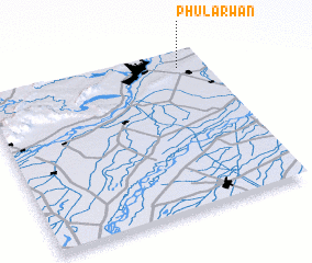 Places with similar names to Phularwān, Pakistan ::
Disclaimer :: Information on this page comes without warranty of any kind |
||
|
Where is Phularwān? Elevation and coordinates ::
Latitude (lat): 32°54'0"N Longitude (lon): 73°53'0"E
Elevation (approx.): 280m (map arrows pan, magnifying glasses zoom) |
||
|
Visiting Phularwān? Hotel/Accommodation ::
Book a hotel in Phularwān Travel Guide ::
Buy a travel guide for Pakistan rental cars ::
car rental offers GPS waypoint ::
download a GPX waypoint (PoI) of Phularwān for your GPS receiver
|
||