|
search place name
|
||
Qubba Ghulām (Sind, Pakistan)Qubba Ghulām is a town in the Sind region of Pakistan. An overview map of the region around Qubba Ghulām is displayed below.
regional and 3d topo map of Qubba Ghulām, Pakistan ::

Qubba Ghulām airports ::
The nearest airport is BDN - Talhar, located 79.2 km south east of Qubba Ghulām.
Other airports nearby include WNS - Nawabshah (89.6 km north), KHI - Karachi Jinnah Intl (133.6 km south west), MJD - Moenjodaro (214.3 km north), Nearby towns ::
Qubba Ghulām Shāh (0.3km north) //
Nūr Khān Chāng (1.6km north) //
Chaundri Muhammad Sādiq (1.7km north east) //
Imām Bakhsh Jatoi (2.0km east) //
Dangra (2.3km south west) //
Tando Jahāniān (2.6km south west) //
Ismāīl Chāng (3.0km north east) //
Tālib Sumro (2.8km west) //
Mullah Farāsh (3.1km north) //
Goth Haroon Sumra (3.1km south west) //
Tāhir Sumra (3.1km west) //
Hāji Bachal Sumra (3.3km west) //
Ibrāhīm Channa (3.4km west) //
Rāni Bāgh (3.7km south west) //
Lālu Māchhi (4.1km south) //
Gopāng (3.7km east) //
Allāh Ditta Chāndia (3.8km south east) //
Tanda Thoro (3.8km south east) //
Jām Shoro (3.9km north west) //
Khuda Bakhsh (4.0km east) //
Sāleh Muhammad Bāghal (4.1km north east) //
Goth Shīdi Kāmbrāni (4.2km south west) //
Muhammad Khān Bahrāni (4.6km north) //
Shīru Māchhi (4.7km north east) //
Hyderābād (5.0km south) //
Qubba Bukhāri Shāh (5.0km north) //
Rakha Khāskheli (5.1km north) //
Tando Saiyid Ghafūr Shāh (4.9km south west) //
Goth Sājam Detha (4.8km west) //
[all distances 'as the bird flies' and approximate] 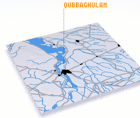 Places with similar names to Qubba Ghulām, Pakistan ::
Disclaimer :: Information on this page comes without warranty of any kind |
||
|
Where is Qubba Ghulām? Elevation and coordinates ::
Latitude (lat): 25°24'40"N Longitude (lon): 68°21'50"E
Elevation (approx.): 36m (map arrows pan, magnifying glasses zoom) |
||
|
Visiting Qubba Ghulām? Hotel/Accommodation ::
Book a hotel in Qubba Ghulām Travel Guide ::
Buy a travel guide for Pakistan rental cars ::
car rental offers GPS waypoint ::
download a GPX waypoint (PoI) of Qubba Ghulām for your GPS receiver
|
||