|
search place name
|
||
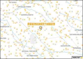
Rahīm Khān Thāhim (Sind, Pakistan)Rahīm Khān Thāhim is a town in the Sind region of Pakistan. An overview map of the region around Rahīm Khān Thāhim is displayed below.
regional and 3d topo map of Rahīm Khān Thāhim, Pakistan ::
Rahīm Khān Thāhim airports ::
The nearest airport is WNS - Nawabshah, located 54.6 km north west of Rahīm Khān Thāhim.
Other airports nearby include BDN - Talhar (108.2 km south), MJD - Moenjodaro (177.7 km north), KHI - Karachi Jinnah Intl (183.8 km south west), SKZ - Sukkur (212.1 km north), Nearby towns ::
Goth Hāji Jāni (0.6km south west) //
Abdul Qādir Jo Goth (1.4km west) //
Goth Nur Muhammad Waryāh (1.4km east) //
Goth Dīn Muhammad (2.0km south west) //
Goth Sheru Rind (1.9km south west) //
Goth Ghulām Muhammad Thāhim (2.0km east) //
Goth Hāji Khāskheli (2.2km north east) //
Goth Sehto (2.3km north) //
Pīr Jāfar (2.2km north east) //
Goth Sāchīn Wadero (2.3km south) //
Goth Hāji Sāwan Buraro (2.4km south west) //
Goth Samar Chakrāni (2.5km south west) //
Goth Muharram Khāskheli (2.7km south) //
Goth Imām Bakhsh (2.7km north east) //
Goth Dāim Thāim (2.8km north east) //
Goth Urs Bijoro (2.8km west) //
Goth Hāji Khuda Bakhsh (3.1km north) //
Goth Rāja Marri (3.2km north west) //
Goth Pīral Makrāni (3.5km south) //
Goth Ghulām Muhammad (3.5km south east) //
Goth Rānjho Khāskheli (3.8km south) //
Goth Mūsa (3.9km north) //
Goth Bijoro (4.1km north) //
Goth Ahmad Barāro (3.8km west) //
Goth Kābul Shāh (3.8km west) //
Goth Sabzal Marri (4.0km west) //
Goth Karār Barāro (4.1km north west) //
Goth Shāh Beg Marri (4.0km east) //
Goth Pīr Bakhsh (4.4km north east) //
[all distances 'as the bird flies' and approximate]  Places with similar names to Rahīm Khān Thāhim, Pakistan :: Disclaimer :: Information on this page comes without warranty of any kind |
||
|
Where is Rahīm Khān Thāhim? Elevation and coordinates ::
Latitude (lat): 25°48'35"N Longitude (lon): 68°41'35"E
Elevation (approx.): 23m (map arrows pan, magnifying glasses zoom) |
||
|
Visiting Rahīm Khān Thāhim? Hotel/Accommodation ::
Book a hotel in Rahīm Khān Thāhim Travel Guide ::
Buy a travel guide for Pakistan rental cars ::
car rental offers GPS waypoint ::
download a GPX waypoint (PoI) of Rahīm Khān Thāhim for your GPS receiver
|
||