|
search place name
|
||
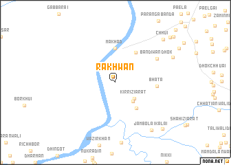
Rakhwān (Punjab, Pakistan)Rakhwān is a town in the Punjab region of Pakistan. An overview map of the region around Rakhwān is displayed below.
regional and 3d topo map of Rakhwān, Pakistan ::
Rakhwān airports ::
The nearest airport is PEW - Peshawar Intl, located 103.0 km north of Rakhwān.
Other airports nearby include ISB - Islamabad Chaklala (140.2 km north east), JAA - Jalalabad (185.5 km north west), SDT - Saidu Sharif (200.3 km north), MFG - Muzaffarabad (215.6 km north east), Nearby towns ::
Kirri Ziārat (3.7km south east) //
Karkāni Ziārat (3.9km south east) //
Kani (5.1km south east) //
Makhad (5.6km north) //
Kundaryāli (5.6km north east) //
Bhata (5.7km east) //
Bandiwān Dhok (6.9km north east) //
Jambolai Kalai (9.2km south east) //
Chhui (9.5km north east) //
Dhok Mahāngān (9.8km south east) //
Mehdi Khān (10.4km north east) //
[all distances 'as the bird flies' and approximate] 
Disclaimer :: Information on this page comes without warranty of any kind |
||
|
Where is Rakhwān? Elevation and coordinates ::
Latitude (lat): 33°5'0"N Longitude (lon): 71°44'0"E
Elevation (approx.): 282m (map arrows pan, magnifying glasses zoom) |
||
|
Visiting Rakhwān? Hotel/Accommodation ::
Book a hotel in Rakhwān Travel Guide ::
Buy a travel guide for Pakistan rental cars ::
car rental offers GPS waypoint ::
download a GPX waypoint (PoI) of Rakhwān for your GPS receiver
|
||