|
search place name
|
||
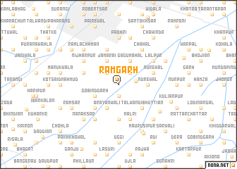
Rāmgarh (Punjab, Pakistan)Rāmgarh is a town in the Punjab region of Pakistan. An overview map of the region around Rāmgarh is displayed below.
regional and 3d topo map of Rāmgarh, Pakistan ::
Rāmgarh airports ::
The nearest airport is LYP - Faisalabad Intl, located 48.7 km north east of Rāmgarh.
Other airports nearby include MUX - Multan Intl (151.1 km south west), LHE - Lahore Allama Iqbal Intl (173.1 km east), Nearby towns ::
Qila Nathu Singh (1.9km south) //
Punnun Pind (2.4km north west) //
Kāleke (2.4km north east) //
Basti Jāngliān (2.4km east) //
Jama Rāi (4.0km north west) //
Gobindgarh (3.7km south west) //
Gagu Mahal (4.0km north east) //
Arāyānwāli (4.0km south west) //
Nūrewāl (4.0km east) //
Angadpura (4.9km south west) //
Talwandi Bhuttiān (4.9km south east) //
Jaura Jullundhur (5.6km south) //
Nūrewāl (5.1km east) //
Arāiyān (5.1km east) //
Chandu Wadāla (5.1km west) //
Khākha (5.8km north) //
Mālri (5.8km south) //
Chhāpiānwāli (6.4km south west) //
Lālpur (6.0km north east) //
Nijharpur (6.0km north west) //
Chahal (6.4km north east) //
Padhri (7.4km north) //
Jite (7.6km north) //
Mahtābpura (7.0km south east) //
Nānak Sar (7.3km south west) //
Basti Dānishmandān (7.3km south east) //
Rām Lachhman (7.3km north west) //
Rām Sar (7.4km south west) //
Burj (7.4km north east) //
[all distances 'as the bird flies' and approximate]  Places with similar names to Rāmgarh, Pakistan ::
// Rumah Gara (MY)
// Rumah Gara (MY)
// Rumah Garah (MY)
// Rumah Garai (MY)
// Rumah Gari (MY)
// Rumah Garu (MY)
// Rumah Kiroh (MY)
// Rāmgarh (BD)
// Rāmkura (BD)
// Romaquira (CO)
Disclaimer :: Information on this page comes without warranty of any kind |
||
|
Where is Rāmgarh? Elevation and coordinates ::
Latitude (lat): 31°1'0"N Longitude (lon): 72°41'0"E
Elevation (approx.): 166m (map arrows pan, magnifying glasses zoom) |
||
|
Visiting Rāmgarh? Hotel/Accommodation ::
Book a hotel in Rāmgarh Travel Guide ::
Buy a travel guide for Pakistan rental cars ::
car rental offers GPS waypoint ::
download a GPX waypoint (PoI) of Rāmgarh for your GPS receiver
|
||