|
search place name
|
||
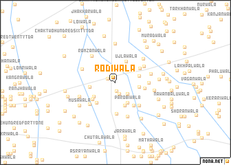
Rodīwāla (Punjab, Pakistan)Rodīwāla is a town in the Punjab region of Pakistan. An overview map of the region around Rodīwāla is displayed below.
regional and 3d topo map of Rodīwāla, Pakistan ::
Rodīwāla airports ::
The nearest airport is MUX - Multan Intl, located 91.4 km south of Rodīwāla.
Other airports nearby include PZH - Zhob (171.4 km west), LYP - Faisalabad Intl (174.2 km east), Nearby towns ::
Chak Three Hundred Thirty-nine TDA (1.2km north west) //
Ahmad Darāwāla (1.4km south) //
Kanglīwāla (1.9km south) //
Chak Three Hundred Forty-one (2.5km south east) //
Ujlāwāla (3.7km north east) //
Parobīwāla (3.7km south east) //
Doseinwāla (3.4km east) //
Chak Three Hundred Forty-three TDA (3.5km east) //
Karīwāla (3.9km south) //
Chak Three Hundred Thirty-five TDA (3.7km west) //
Chak Three Hundred Thirty-five (3.8km south west) //
Gadda Jattānwāla (4.2km south west) //
Chak Three Hundred Thirty-six (4.2km south west) //
Chak Three Hundred Thirty-one TDA (4.1km north east) //
Chak Three Hundred Fifty-two (4.5km south east) //
Kamāl Chishtiwāla (4.2km east) //
Khūnāwāla (5.1km south) //
Thākurwāla (4.8km north east) //
Dād Head (5.0km south east) //
Chak Three Hundred Forty-four TDA (4.6km east) //
Dahdwāla (5.0km south west) //
Ramzānwāla (5.4km north west) //
Chak Three Hundred Thirty-four TDA (5.1km north west) //
Rāmowāla (5.1km east) //
Chak Three Hundred Fifty-three (5.8km south) //
Dorattawāla (5.4km north east) //
Chak Two Hundred Eighty-two (5.5km south west) //
Chamrawāla (6.3km north) //
Kamāl Chishtis Shrine (5.6km east) //
[all distances 'as the bird flies' and approximate] 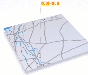 Places with similar names to Rodīwāla, Pakistan ::
Disclaimer :: Information on this page comes without warranty of any kind |
||
|
Where is Rodīwāla? Elevation and coordinates ::
Latitude (lat): 31°0'30"N Longitude (lon): 71°12'55"E
Elevation (approx.): 150m (map arrows pan, magnifying glasses zoom) |
||
|
Visiting Rodīwāla? Hotel/Accommodation ::
Book a hotel in Rodīwāla Travel Guide ::
Buy a travel guide for Pakistan rental cars ::
car rental offers GPS waypoint ::
download a GPX waypoint (PoI) of Rodīwāla for your GPS receiver
|
||