|
search place name
|
||
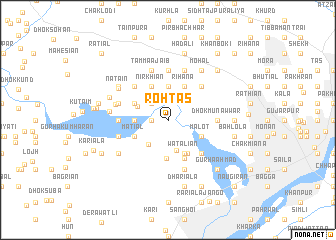
Rohtās (Punjab, Pakistan)Rohtās is a town in the Punjab region of Pakistan. An overview map of the region around Rohtās is displayed below.
regional and 3d topo map of Rohtās, Pakistan ::
Rohtās airports ::
The nearest airport is ISB - Islamabad Chaklala, located 85.0 km north west of Rohtās.
Other airports nearby include RAZ - Rawala Kot Rawalakot (100.0 km north), IXJ - Jammu (121.4 km east), MFG - Muzaffarabad (152.4 km north), SXR - Srinagar (158.3 km north east), Nearby towns ::
Chāh Ganja (1.6km west) //
Kalwantpur (1.6km west) //
Rājo Pindi (2.4km north west) //
Qāzi Husaini (2.4km north west) //
Chhatta (2.4km north west) //
Rihāna Jhīūr (2.8km north east) //
Dhok Bahādur (3.3km south west) //
Dhok Dheri (3.5km south) //
Doiān (3.7km north) //
Nagārchiān (3.1km west) //
Chak Almās (3.1km west) //
Dhok Darbān (3.2km north west) //
Nirkhiān (4.0km north west) //
Gaggar Kalān (3.6km north west) //
Rihāna (4.0km north east) //
Matiāl (3.6km south west) //
Malot (3.6km south east) //
Watāliān (4.0km south east) //
Dhok Bangiāl (4.1km south east) //
Bhoji Garh (4.3km south) //
Kotha (4.6km south) //
Khukha (4.8km north west) //
Maldev (4.8km north east) //
Dhok Nagiāl (4.8km south east) //
Dhok Kaniāl (4.8km south east) //
Dhok Munawwar (4.7km east) //
Saiyid Husain (5.6km north) //
Chak Miāna (4.7km west) //
Tamma Ajāib (5.8km north) //
[all distances 'as the bird flies' and approximate]  Places with similar names to Rohtās, Pakistan ::
Disclaimer :: Information on this page comes without warranty of any kind |
||
|
Where is Rohtās? Elevation and coordinates ::
Latitude (lat): 32°58'0"N Longitude (lon): 73°35'0"E
Elevation (approx.): 264m (map arrows pan, magnifying glasses zoom) |
||
|
Visiting Rohtās? Hotel/Accommodation ::
Book a hotel in Rohtās Travel Guide ::
Buy a travel guide for Pakistan rental cars ::
car rental offers GPS waypoint ::
download a GPX waypoint (PoI) of Rohtās for your GPS receiver
|
||