|
search place name
|
||
Rustamzāi (Punjab, Pakistan)Rustamzāi is a town in the Punjab region of Pakistan. An overview map of the region around Rustamzāi is displayed below.
regional and 3d topo map of Rustamzāi, Pakistan ::

Rustamzāi airports ::
The nearest airport is UET - Quetta, located 126.1 km north west of Rustamzāi.
Other airports nearby include SUL - Sui (157.9 km south east), SKZ - Sukkur (209.6 km south east), PZH - Zhob (269.5 km north east), Nearby towns ::
Bagra Māchhi (1.3km east) //
Jamāli (1.6km north west) //
Mehrāni (1.7km east) //
Jhang Rakho (2.2km north) //
Mehrani (2.5km north) //
Bagra Kulāchi (3.3km north east) //
Mithri (3.9km south) //
Goth Allāyār Khān (4.4km south) //
Mithri Weir (4.5km north) //
Bheri (5.7km south) //
Kalwār (6.2km south) //
Goth Khāra Shāhu Khān (6.9km north) //
Goth Lolai (6.8km south) //
Both Babbar (6.2km east) //
Tāj Rodeni (7.4km south) //
Goth Dittu (6.7km east) //
Goth Mirwāh Khoso (8.2km south) //
Goth Molvi Nūr Ahmad (8.8km south east) //
[all distances 'as the bird flies' and approximate] 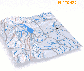 Places with similar names to Rustamzāi, Pakistan :: Disclaimer :: Information on this page comes without warranty of any kind |
||
|
Where is Rustamzāi? Elevation and coordinates ::
Latitude (lat): 29°24'0"N Longitude (lon): 67°48'10"E
Elevation (approx.): 121m (map arrows pan, magnifying glasses zoom) |
||
|
Visiting Rustamzāi? Hotel/Accommodation ::
Book a hotel in Rustamzāi Travel Guide ::
Buy a travel guide for Pakistan rental cars ::
car rental offers GPS waypoint ::
download a GPX waypoint (PoI) of Rustamzāi for your GPS receiver
|
||