|
search place name
|
||
Sabalpur (Punjab, Pakistan)Sabalpur is a town in the Punjab region of Pakistan. An overview map of the region around Sabalpur is displayed below.
regional and 3d topo map of Sabalpur, Pakistan ::

Sabalpur airports ::
The nearest airport is IXJ - Jammu, located 47.2 km north of Sabalpur.
Other airports nearby include ATQ - Amritsar (64.9 km south), LHE - Lahore Allama Iqbal Intl (88.6 km south), IXP - Pathankot (90.5 km east), SXR - Srinagar (188.9 km north), Nearby towns ::
Khichiān (0.8km south) //
Naukriān (0.7km south east) //
Saulpur (0.9km north) //
Sakhe (1.1km south) //
Malo Pātiāl (1.0km west) //
Bhāgot (1.0km west) //
Bhagatpura (1.3km south) //
Kot (1.3km north east) //
Lappewāli (1.7km north east) //
Rāmke (1.8km north west) //
Chohān (1.8km south east) //
Pasrūr (2.3km south west) //
Arki Dogrān (2.2km east) //
Bilaggan (2.2km east) //
Chāhīwāli (2.2km east) //
Nawān Pind (2.5km south east) //
Burheke (2.5km west) //
Jājūpur (2.7km north east) //
Alkāra (2.9km south east) //
Sarāi Shāh Fateh (2.9km north west) //
Chand (3.3km south) //
Bhagniān (3.4km north) //
Sarangpur (3.5km north) //
Matteke (3.5km north) //
Khurpa (3.5km north) //
Chohās (3.6km south east) //
Qādiānwāli (4.1km north east) //
Maddūpur (4.1km north east) //
Changgarān di Khūhi (4.3km south) //
[all distances 'as the bird flies' and approximate] 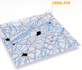 Places with similar names to Sabalpur, Pakistan ::
Disclaimer :: Information on this page comes without warranty of any kind |
||
|
Where is Sabalpur? Elevation and coordinates ::
Latitude (lat): 32°17'10"N Longitude (lon): 74°40'35"E
Elevation (approx.): 243m (map arrows pan, magnifying glasses zoom) |
||
|
Visiting Sabalpur? Hotel/Accommodation ::
Book a hotel in Sabalpur Travel Guide ::
Buy a travel guide for Pakistan rental cars ::
car rental offers GPS waypoint ::
download a GPX waypoint (PoI) of Sabalpur for your GPS receiver
|
||