|
search place name
|
||
Saide Khel (North-West Frontier, Pakistan)Saide Khel is a town in the North-West Frontier region of Pakistan. An overview map of the region around Saide Khel is displayed below.
regional and 3d topo map of Saide Khel, Pakistan ::

Saide Khel airports ::
The nearest airport is PEW - Peshawar Intl, located 177.3 km north of Saide Khel.
Other airports nearby include LYP - Faisalabad Intl (202.0 km south east), PZH - Zhob (205.2 km south west), ISB - Islamabad Chaklala (218.7 km north east), JAA - Jalalabad (231.3 km north), Nearby towns ::
Sirkiān Bānda (0.8km north west) //
Bānda Khairwāla (0.9km south east) //
Khardi Khel (1.3km south west) //
Jogal Bānda (1.3km west) //
Yārikwāl (2.2km south) //
Shīsha (2.7km south west) //
Dabbri Jhok (3.1km south) //
Umar Khel (2.8km east) //
Gūgunwāla (3.5km south west) //
Domanīwāla (3.7km south) //
Pursha Bānda (3.6km south west) //
Bānda Mian (3.7km east) //
Pīr Qamr Sultān (4.5km south) //
Dabbri Jhok (4.5km south east) //
Bānda Pungi (4.4km north east) //
Bānda Dhandi (4.7km north east) //
Mastīwāla (4.9km south west) //
Shinki (5.5km south) //
Bānda ShāhNawāz (5.4km north west) //
Bānda Shāh Nawāz (6.0km north) //
Vada Dast (5.8km south west) //
Bānda Palghozhi (5.8km north east) //
Saiyiduwāli (6.0km south west) //
Batanniān (6.5km south) //
Bānda Kheji (7.0km north) //
Tilokar (6.6km south west) //
Bānda Chashma (6.6km north east) //
Talokrānwāla (6.6km south west) //
Athog (7.4km south) //
[all distances 'as the bird flies' and approximate] 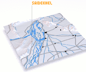 Places with similar names to Saide Khel, Pakistan ::
// Sut-Khol' (RU)
// Stock Hill (US)
// Sayyid Dakhīl (IQ)
// Saidkhāli (BD)
// Satakhāli (BD)
// Seyyed Dakhīl (IR)
// Seyyed Kheyl (IR)
// Sūteh Kheyl (IR)
// Sāda Khel (PK)
// Sade Khel (PK)
Disclaimer :: Information on this page comes without warranty of any kind |
||
|
Where is Saide Khel? Elevation and coordinates ::
Latitude (lat): 32°24'40"N Longitude (lon): 71°14'50"E
Elevation (approx.): 604m (map arrows pan, magnifying glasses zoom) |
||
|
Visiting Saide Khel? Hotel/Accommodation ::
Book a hotel in Saide Khel Travel Guide ::
Buy a travel guide for Pakistan rental cars ::
car rental offers GPS waypoint ::
download a GPX waypoint (PoI) of Saide Khel for your GPS receiver
|
||