|
search place name
|
||
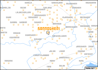
Sanno Dheri (North-West Frontier, Pakistan)Sanno Dheri is a town in the North-West Frontier region of Pakistan. An overview map of the region around Sanno Dheri is displayed below.
regional and 3d topo map of Sanno Dheri, Pakistan ::
Sanno Dheri airports ::
The nearest airport is PEW - Peshawar Intl, located 75.7 km west of Sanno Dheri.
Other airports nearby include SDT - Saidu Sharif (77.7 km north), ISB - Islamabad Chaklala (90.6 km south east), MFG - Muzaffarabad (112.1 km east), RAZ - Rawala Kot Rawalakot (139.5 km east), Nearby towns ::
Narai Shiggi (1.9km south east) //
Balari Dheri (1.9km north east) //
Jagannāth (2.0km south west) //
Urmalo Dheri (2.2km north) //
Bar Sadril (2.4km north east) //
Khāna Dheri (2.3km north west) //
Jaure (2.3km north west) //
Rishka (2.7km west) //
Kuz Kadai (3.3km north) //
Kānezai Dheri (3.3km south east) //
Serai Kili (3.5km north west) //
Aūr Sadri (4.0km north) //
Safukhel Dheri (3.5km east) //
Bar Kadai (4.3km north east) //
Qāsim Kili (4.0km west) //
Dulai Dheri (4.2km north west) //
Pīr Khān (4.4km south west) //
Ghokhtu Dheri (5.0km north) //
Sikandari Kili (4.5km north east) //
Sikandari Dheri (4.6km north east) //
Pāinda Dheri (5.3km north) //
Bāhri Dheri (5.1km south west) //
Sudher (5.4km north west) //
Ghāzīkot (5.4km north west) //
Mīr Shāh Dheri (6.0km north) //
Matra (5.8km north east) //
Badraga Dheri (6.3km north) //
Shamlo Dheri (5.5km north east) //
Dāgi (6.2km north) //
[all distances 'as the bird flies' and approximate]  Places with similar names to Sanno Dheri, Pakistan ::
Disclaimer :: Information on this page comes without warranty of any kind |
||
|
Where is Sanno Dheri? Elevation and coordinates ::
Latitude (lat): 34°6'50"N Longitude (lon): 72°19'20"E
Elevation (approx.): 350m (map arrows pan, magnifying glasses zoom) |
||
|
Visiting Sanno Dheri? Hotel/Accommodation ::
Book a hotel in Sanno Dheri Travel Guide ::
Buy a travel guide for Pakistan rental cars ::
car rental offers GPS waypoint ::
download a GPX waypoint (PoI) of Sanno Dheri for your GPS receiver
|
||