|
search place name
|
||
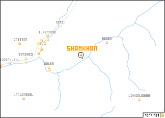
Sham Khān (North-West Frontier, Pakistan)Sham Khān is a town in the North-West Frontier region of Pakistan. An overview map of the region around Sham Khān is displayed below.
regional and 3d topo map of Sham Khān, Pakistan ::
Sham Khān airports ::
The nearest airport is SDT - Saidu Sharif, located 129.1 km south of Sham Khān.
Other airports nearby include PEW - Peshawar Intl (222.4 km south), JAA - Jalalabad (222.6 km south west), MFG - Muzaffarabad (222.7 km south east), Nearby towns ::
Romen (5.8km north east) //
Golen (6.5km west) //
Bobaka (6.6km south west) //
Maroi (8.5km north west) //
Chamuruk (7.7km north west) //
Mashāgho Lasht (7.7km north west) //
Turen More (8.3km north west) //
[all distances 'as the bird flies' and approximate]  Places with similar names to Sham Khān, Pakistan ::
// Chemikhino (RU)
// Cham-e Khān (IR)
// Cham Khūn (IR)
// Sīāmkhānī (IR)
// Shambe Khān (PK)
// Shumikhino (RU)
// Shimbekihun (SL)
Disclaimer :: Information on this page comes without warranty of any kind |
||
|
Where is Sham Khān? Elevation and coordinates ::
Latitude (lat): 35°57'0"N Longitude (lon): 72°3'0"E
Elevation (approx.): 3392m (map arrows pan, magnifying glasses zoom) |
||
|
Visiting Sham Khān? Hotel/Accommodation ::
Book a hotel in Sham Khān Travel Guide ::
Buy a travel guide for Pakistan rental cars ::
car rental offers GPS waypoint ::
download a GPX waypoint (PoI) of Sham Khān for your GPS receiver
|
||