|
search place name
|
||
Sheikh Kālu (Punjab, Pakistan)Sheikh Kālu is a town in the Punjab region of Pakistan. An overview map of the region around Sheikh Kālu is displayed below.
regional and 3d topo map of Sheikh Kālu, Pakistan ::

Sheikh Kālu airports ::
The nearest airport is LYP - Faisalabad Intl, located 44.0 km north west of Sheikh Kālu.
Other airports nearby include LHE - Lahore Allama Iqbal Intl (105.5 km north east), ATQ - Amritsar (148.1 km north east), MUX - Multan Intl (215.5 km south west), IXJ - Jammu (219.2 km north east), Nearby towns ::
Garhi (0.1km west) //
Popela (0.3km north west) //
Thatta Nādir Kharl (0.9km south) //
Rājanpur (1.1km north) //
Wān Mori (1.7km north) //
Patrāna (1.6km west) //
Hassoke (2.1km south west) //
Wīsān da Thatta (2.1km north east) //
Pīre da Thatta (2.3km east) //
Agra Khu (2.5km east) //
Maulānewāla (2.8km north east) //
Khāi da Tibba (2.7km south east) //
Dauāna (4.0km north west) //
Rājanpur Vāins (4.0km north east) //
Buchiāna (3.7km north west) //
Chhimeke (3.7km north east) //
Thatta Sāiān Chhimeke (3.7km north east) //
Langār (3.8km south east) //
Chāh Mulānwāla (4.2km north east) //
Mughlānwāla (4.0km east) //
Kot Yār Muhammad (4.5km south west) //
Chak Lachhman Dās (4.5km south east) //
Nūrka Thatta (4.3km south east) //
Nawān Pind (4.8km north) //
Thatta Nūrke (4.8km north east) //
Rajab (4.9km south east) //
Haiboke (4.6km east) //
Jandwāli (5.4km north) //
Wān Rajab (5.4km south) //
[all distances 'as the bird flies' and approximate] 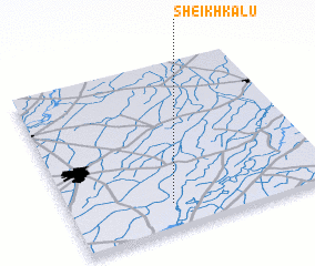 Places with similar names to Sheikh Kālu, Pakistan ::
// Choqā Gol (IR)
// Chak Goāli (BD)
// Chak Kukil (BD)
// Chikakala (ZM)
// Sheykh Kal (IR)
// Sheykh Kolā (IR)
// Sheykh Kolā (IR)
// Sheykh Kolá (IR)
// Shaikh Kalle (PK)
// Shaikh Kili (PK)
Disclaimer :: Information on this page comes without warranty of any kind |
||
|
Where is Sheikh Kālu? Elevation and coordinates ::
Latitude (lat): 31°9'0"N Longitude (lon): 73°23'0"E
Elevation (approx.): 181m (map arrows pan, magnifying glasses zoom) |
||
|
Visiting Sheikh Kālu? Hotel/Accommodation ::
Book a hotel in Sheikh Kālu Travel Guide ::
Buy a travel guide for Pakistan rental cars ::
car rental offers GPS waypoint ::
download a GPX waypoint (PoI) of Sheikh Kālu for your GPS receiver
|
||