|
search place name
|
||
Sher Mandi (Pakistan)Sher Mandi is a town in Pakistan. An overview map of the region around Sher Mandi is displayed below.
regional and 3d topo map of Sher Mandi, Pakistan ::

Sher Mandi airports ::
The nearest airport is RAZ - Rawala Kot Rawalakot, located 43.1 km north of Sher Mandi.
Other airports nearby include ISB - Islamabad Chaklala (68.8 km west), MFG - Muzaffarabad (101.5 km north), SXR - Srinagar (106.2 km north east), IXJ - Jammu (128.1 km south east), Nearby towns ::
Thiliara (1.7km east) //
Sarhota (2.0km north west) //
Bun Dhār (2.0km south east) //
Jhandāl (2.5km north) //
Sunān (2.4km south west) //
Tarhiān (2.5km west) //
Kuin (2.9km north west) //
Kothiān (3.1km south) //
Bāwāki Dhok (3.0km south east) //
Rametar (2.9km east) //
Chaliān (3.4km south west) //
Siāliān (3.6km north west) //
Darliah (3.9km south) //
Dhok Mangani (4.0km south) //
Hārnāh (3.5km east) //
Rajur (4.0km north west) //
Garhuta (4.0km north west) //
Anbār (4.3km south east) //
Kathār (4.4km north west) //
Dhok Darun (4.6km south) //
Dungi (4.4km north east) //
Nār Manhda (4.2km west) //
Karuhin (5.0km north) //
Nurūchil (4.3km east) //
Komili (4.4km east) //
Gulpur (5.1km south east) //
Churangil (5.0km east) //
Chachlār (5.5km north west) //
Tamphari (5.0km west) //
[all distances 'as the bird flies' and approximate] 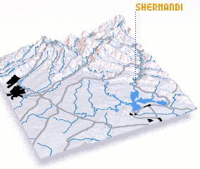 Places with similar names to Sher Mandi, Pakistan ::
// Charmant (HT)
// Chiaramonti (IT)
// Chiaromonte (IT)
// Charmont (FR)
// Charmant (FR)
// Charmont (FR)
// Chirmont (FR)
Disclaimer :: Information on this page comes without warranty of any kind |
||
|
Where is Sher Mandi? Elevation and coordinates ::
Latitude (lat): 33°27'40"N Longitude (lon): 73°49'0"E
Elevation (approx.): 594m (map arrows pan, magnifying glasses zoom) |
||
|
Visiting Sher Mandi? Hotel/Accommodation ::
Book a hotel in Sher Mandi Travel Guide ::
Buy a travel guide for Pakistan rental cars ::
car rental offers GPS waypoint ::
download a GPX waypoint (PoI) of Sher Mandi for your GPS receiver
|
||