|
search place name
|
||
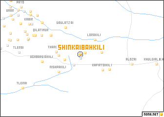
Shīnkaibāh Kili (Balochistān, Pakistan)Shīnkaibāh Kili is a town in the Balochistān region of Pakistan. An overview map of the region around Shīnkaibāh Kili is displayed below.
regional and 3d topo map of Shīnkaibāh Kili, Pakistan ::
Shīnkaibāh Kili airports ::
The nearest airport is PZH - Zhob, located 118.0 km north east of Shīnkaibāh Kili.
Other airports nearby include UET - Quetta (158.6 km west), Nearby towns ::
Akhtarzai (0.3km west) //
Nawāb Muhammad Khān Qila (1.4km north east) //
Akhtarzai Kili (2.2km south west) //
Alladādzai (3.5km west) //
Wulang (4.1km east) //
Lora Kili (5.0km north east) //
Shinkai Kili (4.6km west) //
Kāfir Toi Kili (4.9km south east) //
Tharowāl (5.3km west) //
Nishpa kili (5.5km south west) //
Aukha Shai (6.0km south east) //
Daulatzai (7.8km north west) //
Badrawāle Kili (8.1km north west) //
[all distances 'as the bird flies' and approximate] 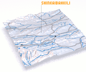 Places with similar names to Shīnkaibāh Kili, Pakistan ::
Disclaimer :: Information on this page comes without warranty of any kind |
||
|
Where is Shīnkaibāh Kili? Elevation and coordinates ::
Latitude (lat): 30°40'40"N Longitude (lon): 68°30'50"E
Elevation (approx.): 1548m (map arrows pan, magnifying glasses zoom) |
||
|
Visiting Shīnkaibāh Kili? Hotel/Accommodation ::
Book a hotel in Shīnkaibāh Kili Travel Guide ::
Buy a travel guide for Pakistan rental cars ::
car rental offers GPS waypoint ::
download a GPX waypoint (PoI) of Shīnkaibāh Kili for your GPS receiver
|
||