|
search place name
|
||
Shinkai Shākh (Balochistān, Pakistan)Shinkai Shākh is a town in the Balochistān region of Pakistan. An overview map of the region around Shinkai Shākh is displayed below.
regional and 3d topo map of Shinkai Shākh, Pakistan ::

Shinkai Shākh airports ::
The nearest airport is PZH - Zhob, located 63.5 km south west of Shinkai Shākh.
Other airports nearby include MUX - Multan Intl (228.8 km south east), Nearby towns ::
Shag Khawāzha (6.9km west) //
Khalīlzai Shor (7.7km east) //
Hurmez (7.7km east) //
Khank Chat (9.3km north east) //
Wyeze Kār Kāni (10.5km south east) //
Nishpa (10.8km south east) //
[all distances 'as the bird flies' and approximate] 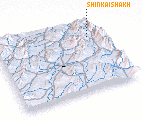 Places with similar names to Shinkai Shākh, Pakistan ::
// Changch'ŏk (KR)
// Changch'ŏk (KR)
// Changch'ŏk (KR)
// Ch'ang-shih-k'ou (TW)
// Changchaigou (CN)
// Shangshiqiao (CN)
// Shangshiqiao (CN)
// Shangshiqiao (CN)
// Shuangshiqiao (CN)
// Chengau Shaga (MM)
Disclaimer :: Information on this page comes without warranty of any kind |
||
|
Where is Shinkai Shākh? Elevation and coordinates ::
Latitude (lat): 31°47'46"N Longitude (lon): 69°53'43"E
Elevation (approx.): 1500m (map arrows pan, magnifying glasses zoom) |
||
|
Visiting Shinkai Shākh? Hotel/Accommodation ::
Book a hotel in Shinkai Shākh Travel Guide ::
Buy a travel guide for Pakistan rental cars ::
car rental offers GPS waypoint ::
download a GPX waypoint (PoI) of Shinkai Shākh for your GPS receiver
|
||