|
search place name
|
||
Sināhadi (Sind, Pakistan)Sināhadi is a town in the Sind region of Pakistan. An overview map of the region around Sināhadi is displayed below.
regional and 3d topo map of Sināhadi, Pakistan ::

Sināhadi airports ::
The nearest airport is BDN - Talhar, located 85.1 km south west of Sināhadi.
Other airports nearby include WNS - Nawabshah (127.8 km north west), JSA - Jaisalmer (219.7 km north east), MJD - Moenjodaro (240.4 km north west), Nearby towns ::
Goth Hāshim Shāh (3.5km south east) //
Jān Muhammad Bhurgari (3.6km north east) //
Goth Muhammad Shāh (3.7km south east) //
Goth Kāru (3.8km north east) //
Goth Ali Akbar Shāh (4.0km east) //
Nabban Khān Bhurgari (4.3km south west) //
Goth Jurial Shāh (4.1km south east) //
Muhammad Ishāq Pali (4.5km south) //
Budho Khān Khāskheli (4.4km south west) //
Ahmad Nukrach (4.8km north east) //
Goth Mauj Ali Shāh (4.6km south east) //
Ayūb Khān Bhurgari (5.3km south) //
Ghulām Muhammad Nukrach (5.3km north east) //
Hāji Ali Muhammad Pali (5.3km south west) //
Gulāb Shāh (5.5km south east) //
Sinhro (5.5km west) //
Jāmbho Kandi (5.9km north west) //
Hāji Muhammad Siddīq (5.8km south west) //
Goth Nawāz Ali Shāh (6.3km south east) //
Umed Ali Rind (6.2km west) //
Sono Rind (6.3km north west) //
Arāro Bhurgari (6.6km south west) //
Goth Khān (6.9km south east) //
Hāji Sābu Rind (6.6km west) //
Goth Hāji Ārīsar (6.9km north east) //
Muhammad Ismāil Bhurgari (7.7km south) //
Umar Bhambro (7.1km west) //
Pithoro (7.8km north east) //
Bādal Khāskheli (7.9km south west) //
[all distances 'as the bird flies' and approximate] 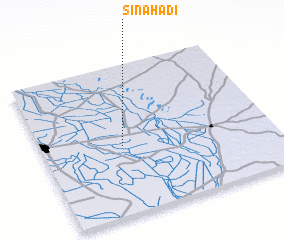 Places with similar names to Sināhadi, Pakistan ::
Disclaimer :: Information on this page comes without warranty of any kind |
||
|
Where is Sināhadi? Elevation and coordinates ::
Latitude (lat): 25°27'20"N Longitude (lon): 69°20'45"E
Elevation (approx.): 9m (map arrows pan, magnifying glasses zoom) |
||
|
Visiting Sināhadi? Hotel/Accommodation ::
Book a hotel in Sināhadi Travel Guide ::
Buy a travel guide for Pakistan rental cars ::
car rental offers GPS waypoint ::
download a GPX waypoint (PoI) of Sināhadi for your GPS receiver
|
||