|
search place name
|
||
Siwāgwāla (Punjab, Pakistan)Siwāgwāla is a town in the Punjab region of Pakistan. An overview map of the region around Siwāgwāla is displayed below.
regional and 3d topo map of Siwāgwāla, Pakistan ::

Siwāgwāla airports ::
The nearest airport is MUX - Multan Intl, located 89.9 km south of Siwāgwāla.
Other airports nearby include LYP - Faisalabad Intl (129.4 km east), Nearby towns ::
Bhukwāla (1.3km south) //
Khairewāla (2.5km south) //
Faqīrewāla (4.4km south east) //
Bhindwālwāla (4.6km south) //
Shāh Ālamwāla (4.5km south west) //
Keāriānwāla (5.1km south) //
Sultānwāla (5.3km south) //
Khiārewāla (5.8km south) //
Hājī Muhammad (6.5km south) //
Khānwāla (6.5km south) //
Mughlānwāla (7.1km south) //
Rājāwāla (8.1km south) //
Langānwāla (8.5km south west) //
Jānāwāla (9.1km north) //
[all distances 'as the bird flies' and approximate] 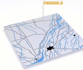 Places with similar names to Siwāgwāla, Pakistan :: Disclaimer :: Information on this page comes without warranty of any kind |
||
|
Where is Siwāgwāla? Elevation and coordinates ::
Latitude (lat): 30°58'20"N Longitude (lon): 71°43'0"E
Elevation (approx.): 146m (map arrows pan, magnifying glasses zoom) |
||
|
Visiting Siwāgwāla? Hotel/Accommodation ::
Book a hotel in Siwāgwāla Travel Guide ::
Buy a travel guide for Pakistan rental cars ::
car rental offers GPS waypoint ::
download a GPX waypoint (PoI) of Siwāgwāla for your GPS receiver
|
||