|
search place name
|
||
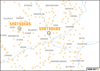
Smatsokas (North-West Frontier, Pakistan)Smatsokas is a town in the North-West Frontier region of Pakistan. An overview map of the region around Smatsokas is displayed below.
regional and 3d topo map of Smatsokas, Pakistan ::
Smatsokas airports ::
The nearest airport is SDT - Saidu Sharif, located 57.7 km south east of Smatsokas.
Other airports nearby include PEW - Peshawar Intl (134.6 km south), JAA - Jalalabad (153.1 km south west), MFG - Muzaffarabad (174.4 km south east), ISB - Islamabad Chaklala (204.8 km south east), Nearby towns ::
Ghundakai (0.6km south) //
Nangarkārai (1.4km north east) //
Dodha (1.5km south east) //
Kotkai (1.7km north) //
Kochkal (1.5km west) //
Chutiātan (2.3km south) //
Girgat (2.3km north) //
Bādai Bānda (2.3km north east) //
Ich Kili (2.8km south) //
Serai Bāba Sāhib (2.8km north) //
Ganorai (2.9km south west) //
Chutiātan (3.1km south) //
Kaso (3.3km north east) //
Bar Hunkār (3.4km south east) //
Kalsho (3.7km north) //
Serai (3.2km east) //
Sirātai (3.1km east) //
Jabalok Bānda (3.9km south) //
Rehānkot (3.9km north) //
Jon Bānda (4.0km south) //
Dīr (4.1km north) //
Taus (4.0km south west) //
Damharkola (3.5km west) //
Lara Bānda (4.4km north) //
Hunkār (4.1km south east) //
Abākanr (4.1km south west) //
Allāh (4.1km north west) //
Qola (4.9km south) //
Kas (5.0km north) //
[all distances 'as the bird flies' and approximate] 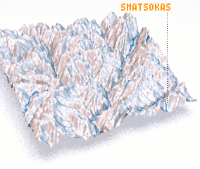 Places with similar names to Smatsokas, Pakistan ::
// Smatso Kas (PK)
Disclaimer :: Information on this page comes without warranty of any kind |
||
|
Where is Smatsokas? Elevation and coordinates ::
Latitude (lat): 35°10'0"N Longitude (lon): 71°53'20"E
Elevation (approx.): 1244m (map arrows pan, magnifying glasses zoom) |
||
|
Visiting Smatsokas? Hotel/Accommodation ::
Book a hotel in Smatsokas Travel Guide ::
Buy a travel guide for Pakistan rental cars ::
car rental offers GPS waypoint ::
download a GPX waypoint (PoI) of Smatsokas for your GPS receiver
|
||