|
search place name
|
||
Sultānwāla (Punjab, Pakistan)Sultānwāla is a town in the Punjab region of Pakistan. An overview map of the region around Sultānwāla is displayed below.
regional and 3d topo map of Sultānwāla, Pakistan ::

Sultānwāla airports ::
The nearest airport is PEW - Peshawar Intl, located 118.5 km north of Sultānwāla.
Other airports nearby include JAA - Jalalabad (179.9 km north west), ISB - Islamabad Chaklala (180.9 km north east), SDT - Saidu Sharif (228.6 km north east), LYP - Faisalabad Intl (234.3 km south east), Nearby towns ::
Māna Sāndwāla (1.9km south) //
Chak Sarkār (1.8km north east) //
Jantiwāla (2.3km north) //
Sodhri (2.3km south west) //
Himewāla (2.7km north west) //
Ghāzīwāl (2.7km south east) //
Samandwāla (3.2km north) //
Gogrānwāla (2.9km west) //
Misri Khānwāla (3.4km north east) //
Kurwānwāla (4.0km north) //
Samandwāla (4.1km north) //
Baki Khelānwāla (3.9km south east) //
Ūduwāla (3.8km east) //
Ramzānwāla (4.4km north west) //
Kacha Kamar Mushāni (4.7km north) //
Bambānwāli (4.3km north west) //
Hakimwāla (4.3km south east) //
Taniwāla (4.5km south west) //
Zeri Algadi (4.4km north west) //
Kānjuwāla (4.7km south west) //
Ghāziwāl (4.8km west) //
Kutki (5.7km north) //
Mehrbānwāla (5.4km north west) //
Qāzi Sher Muhammadwāla (5.7km north east) //
Abdul Rahīm Khān (5.5km east) //
Murghāwāla (6.4km north east) //
Saryānwāla (6.7km south east) //
Gagreli (6.4km east) //
Dalla Mīrwāla (7.3km south west) //
[all distances 'as the bird flies' and approximate] 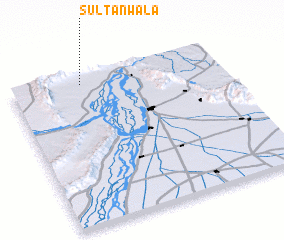 Places with similar names to Sultānwāla, Pakistan ::
// Sultaniwāla (PK)
// Sultāniwāla (PK)
// Sultanwāla (PK)
// Sultanwāla (PK)
// Sultānwala (PK)
// Sultānwāla (PK)
// Sultānwāla (PK)
// Sultānwāla (PK)
// Sultānwāla (PK)
// Sultānwāla (PK)
Disclaimer :: Information on this page comes without warranty of any kind |
||
|
Where is Sultānwāla? Elevation and coordinates ::
Latitude (lat): 32°56'10"N Longitude (lon): 71°20'5"E
Elevation (approx.): 264m (map arrows pan, magnifying glasses zoom) |
||
|
Visiting Sultānwāla? Hotel/Accommodation ::
Book a hotel in Sultānwāla Travel Guide ::
Buy a travel guide for Pakistan rental cars ::
car rental offers GPS waypoint ::
download a GPX waypoint (PoI) of Sultānwāla for your GPS receiver
|
||