|
search place name
|
||
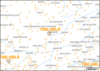
Tāhliwāla (Punjab, Pakistan)Tāhliwāla is a town in the Punjab region of Pakistan. An overview map of the region around Tāhliwāla is displayed below.
regional and 3d topo map of Tāhliwāla, Pakistan ::
Tāhliwāla airports ::
The nearest airport is MUX - Multan Intl, located 69.4 km north west of Tāhliwāla.
Other airports nearby include LYP - Faisalabad Intl (199.8 km north east), RYK - Rahim Yar Khan Sheikh Zayed (227.0 km south west), Nearby towns ::
Ali Ganjwāla (0.7km west) //
Ladha Bohr (0.9km north east) //
Jandwāla (2.0km south west) //
Nūr Ilāhiwāla (2.0km south west) //
Chak Three M (2.3km south east) //
Khillowāla (2.7km south west) //
Mānjha Kotla (3.8km south east) //
Jamāla (3.8km south west) //
Bhopatpur (4.2km south east) //
Chak Two Hundred Twenty-seven WB (4.2km north west) //
Langawāla (4.2km east) //
Qāzi Sādiqwāh (4.7km north east) //
Beriānwāla (4.8km south) //
Sādhun Shāhwāla (4.8km south west) //
Chak Two Hundred Twenty-seven WB (4.4km north west) //
Lālo (4.7km north east) //
Khabbānwāla (5.2km south) //
Chak Two Hundred Twenty-one (5.4km north) //
Jhandīr (4.9km south east) //
Buddho (4.8km east) //
Darweshwāla (6.2km south) //
Chak Two Hundred Nineteen WB (5.9km north west) //
Chak Two Hundred Fifteen WB (6.3km north) //
Haveliān (6.2km south east) //
Gāhi Mammar (6.3km south) //
Uralwāla (6.3km south west) //
Chak Two Hundred Thirty-one WB (6.0km west) //
Chak Two Hundred Thirteen WB (6.9km north) //
Chak One M (6.2km north east) //
[all distances 'as the bird flies' and approximate] 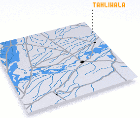 Places with similar names to Tāhliwāla, Pakistan ::
Disclaimer :: Information on this page comes without warranty of any kind |
||
|
Where is Tāhliwāla? Elevation and coordinates ::
Latitude (lat): 29°47'50"N Longitude (lon): 71°58'0"E
Elevation (approx.): 126m (map arrows pan, magnifying glasses zoom) |
||
|
Visiting Tāhliwāla? Hotel/Accommodation ::
Book a hotel in Tāhliwāla Travel Guide ::
Buy a travel guide for Pakistan rental cars ::
car rental offers GPS waypoint ::
download a GPX waypoint (PoI) of Tāhliwāla for your GPS receiver
|
||