|
search place name
|
||
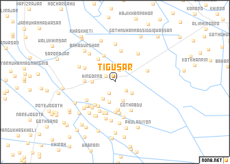
Tigusar (Sind, Pakistan)Tigusar is a town in the Sind region of Pakistan. An overview map of the region around Tigusar is displayed below.
regional and 3d topo map of Tigusar, Pakistan ::
Tigusar airports ::
The nearest airport is WNS - Nawabshah, located 98.8 km north west of Tigusar.
Other airports nearby include BDN - Talhar (105.9 km south), MJD - Moenjodaro (207.2 km north west), JSA - Jaisalmer (208.5 km north east), SKZ - Sukkur (224.4 km north), Nearby towns ::
Goth Gulāb Panwhar (1.7km north west) //
Goth Wadero Ārib Panwhar (2.0km south west) //
Hāji Imām Bakhsh (2.1km north) //
Wesāya Khān Buroro (2.2km north) //
Goth Abdur Rahmān Baloch (2.2km south east) //
Yār Muhammad (2.7km north west) //
Ismāīl (3.1km north west) //
Allāh Bakhsh Nizāmāni (3.1km north west) //
Goth Mīr Abdullāh Khān (3.3km south) //
Goth Khingi Shar Baloch (3.1km south east) //
Goth Muhammad Sulaimān (3.3km south) //
Goth Sāleh Khāskheli (3.3km south west) //
Hingorno (3.3km west) //
Goth Shāhdād Khān (4.5km south) //
Muhammad (4.5km north west) //
Abdul Nabi Brāhui (4.6km north) //
Goth Allāh Bachāyo (4.7km south west) //
Goth Ali Murād Faqīr (4.7km south west) //
Goth Idal (4.9km south) //
Goth Tāj Muhammad (4.5km west) //
Goth Muhammad Sāleh (5.1km south) //
Hāji Hāshim Baloch (5.2km north) //
Goth Tāhir (5.2km south) //
Goth Abdu (5.2km south east) //
Goth Jāffar Khāskheli (5.3km south west) //
Goth Khān Muhammad (5.4km south) //
Jān Muhammad Pahor (5.0km north west) //
Goth Hāji Muhammad Ismaīl (5.1km south west) //
Fazal Muhammad Baloch (5.1km east) //
[all distances 'as the bird flies' and approximate] 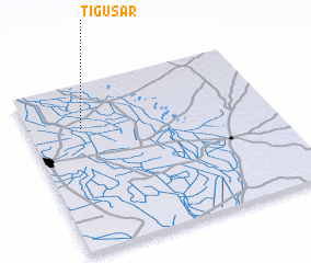 Places with similar names to Tigusar, Pakistan ::
Disclaimer :: Information on this page comes without warranty of any kind |
||
|
Where is Tigusar? Elevation and coordinates ::
Latitude (lat): 25°44'0"N Longitude (lon): 69°13'0"E
Elevation (approx.): 15m (map arrows pan, magnifying glasses zoom) |
||
|
Visiting Tigusar? Hotel/Accommodation ::
Book a hotel in Tigusar Travel Guide ::
Buy a travel guide for Pakistan rental cars ::
car rental offers GPS waypoint ::
download a GPX waypoint (PoI) of Tigusar for your GPS receiver
|
||