|
search place name
|
||
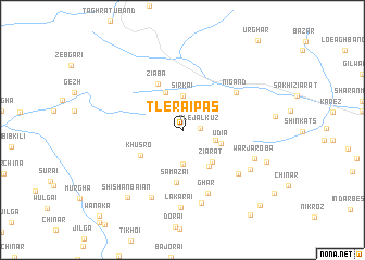
Tlerai Pās (Balochistān, Pakistan)Tlerai Pās is a town in the Balochistān region of Pakistan. An overview map of the region around Tlerai Pās is displayed below.
regional and 3d topo map of Tlerai Pās, Pakistan ::
Tlerai Pās airports ::
The nearest airport is UET - Quetta, located 109.2 km south west of Tlerai Pās.
Other airports nearby include KDH - Kandahar (178.0 km west), PZH - Zhob (178.2 km east), Nearby towns ::
Tlejal Kūz (1.6km east) //
Psha (3.0km north east) //
Toraghar (3.6km south) //
Sirkai (3.6km north) //
Ibrāhim Kats (3.1km east) //
Skhobai (4.1km north) //
Udia (3.7km east) //
Ziārat (4.2km south east) //
Ziārat (4.4km south east) //
Khusro (4.5km south west) //
Ziāba (5.2km north west) //
Samazai (5.4km south) //
Nigand (6.1km north east) //
Ghār (6.9km south) //
Wuchobi (6.6km south east) //
Naghar (7.5km south) //
Amzarai (7.7km south) //
Lakārai (7.9km south) //
Warjaroba (7.0km south east) //
Murghakai (7.2km south east) //
Shishan Baiān (8.5km south west) //
Marsina (8.1km south east) //
Shīnshob (10.3km south east) //
Shīnshob (10.6km south east) //
Wanaka (11.5km south west) //
[all distances 'as the bird flies' and approximate] 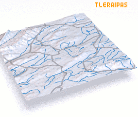 Places with similar names to Tlerai Pās, Pakistan :: Disclaimer :: Information on this page comes without warranty of any kind |
||
|
Where is Tlerai Pās? Elevation and coordinates ::
Latitude (lat): 31°1'55"N Longitude (lon): 67°38'0"E
Elevation (approx.): 2411m (map arrows pan, magnifying glasses zoom) |
||
|
Visiting Tlerai Pās? Hotel/Accommodation ::
Book a hotel in Tlerai Pās Travel Guide ::
Buy a travel guide for Pakistan rental cars ::
car rental offers GPS waypoint ::
download a GPX waypoint (PoI) of Tlerai Pās for your GPS receiver
|
||