|
search place name
|
||
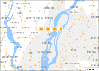
Ubhānanwāla (Punjab, Pakistan)Ubhānanwāla is a town in the Punjab region of Pakistan. An overview map of the region around Ubhānanwāla is displayed below.
regional and 3d topo map of Ubhānanwāla, Pakistan ::
Ubhānanwāla airports ::
The nearest airport is LYP - Faisalabad Intl, located 72.7 km east of Ubhānanwāla.
Other airports nearby include MUX - Multan Intl (146.0 km south west), Nearby towns ::
Haweli Ghulām Jannat (NaNkm north) //
Jharki (1.9km north) //
Dhuin (1.9km north) //
Topa Bela (1.9km north) //
Chak Ganesh Dās (1.9km south) //
Chak Ganesh Dās (2.5km north west) //
Mahram Siāl (3.7km north west) //
Dhidoāna (4.0km south west) //
Bela Mirjāna (3.7km south east) //
Lidoāna (4.1km south) //
Chāh Bāhmanwāla (4.2km east) //
Massan (4.7km west) //
Kharkan (5.6km north) //
Basti Pathān (4.9km south west) //
Chāh Rohelwāla (5.7km south) //
Bela Jhabāna (5.4km east) //
Samādh Jinda Kaliyāna (5.6km west) //
Jandrān (5.6km east) //
Khāna Bāti (5.8km east) //
Basti Baliānan (6.4km south east) //
Chāh Thakurwāla (6.4km south east) //
Chāh Dhāriwāla (6.6km south east) //
Kot Bahādur (6.3km west) //
Jhugge Rang Shāh (7.4km south) //
Chauri Nunān (7.4km south) //
Kharora (7.2km south east) //
Tahli Gadānwāli (7.6km south) //
Habīb (6.7km east) //
Patoāna (6.7km east) //
[all distances 'as the bird flies' and approximate] 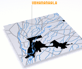 Places with similar names to Ubhānanwāla, Pakistan :: Disclaimer :: Information on this page comes without warranty of any kind |
||
|
Where is Ubhānanwāla? Elevation and coordinates ::
Latitude (lat): 31°19'0"N Longitude (lon): 72°14'0"E
Elevation (approx.): 157m (map arrows pan, magnifying glasses zoom) |
||
|
Visiting Ubhānanwāla? Hotel/Accommodation ::
Book a hotel in Ubhānanwāla Travel Guide ::
Buy a travel guide for Pakistan rental cars ::
car rental offers GPS waypoint ::
download a GPX waypoint (PoI) of Ubhānanwāla for your GPS receiver
|
||