|
search place name
|
||
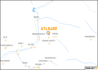
Utla Jor (North-West Frontier, Pakistan)Utla Jor is a town in the North-West Frontier region of Pakistan. An overview map of the region around Utla Jor is displayed below.
regional and 3d topo map of Utla Jor, Pakistan ::
Utla Jor airports ::
The nearest airport is MFG - Muzaffarabad, located 84.7 km south west of Utla Jor.
Other airports nearby include GIL - Gilgit (107.2 km north), RAZ - Rawala Kot Rawalakot (128.5 km south), SXR - Srinagar (134.2 km south east), SDT - Saidu Sharif (149.5 km west), Nearby towns ::
Pari (0.9km south) //
Kothi di Keri (1.5km south east) //
Dāhak (2.2km east) //
Kārwāli Basti (3.2km south) //
Tarla Jor (2.9km north west) //
Bābun di Basti (3.1km west) //
Shāhwāli di Basti (3.6km south west) //
Besal (6.8km north west) //
Jabba Wetār (6.6km south west) //
Wetār (7.3km south west) //
[all distances 'as the bird flies' and approximate]  Places with similar names to Utla Jor, Pakistan ::
// Udlejre (DK)
Disclaimer :: Information on this page comes without warranty of any kind |
||
|
Where is Utla Jor? Elevation and coordinates ::
Latitude (lat): 34°59'55"N Longitude (lon): 73°58'25"E
Elevation (approx.): 3302m (map arrows pan, magnifying glasses zoom) |
||
|
Visiting Utla Jor? Hotel/Accommodation ::
Book a hotel in Utla Jor Travel Guide ::
Buy a travel guide for Pakistan rental cars ::
car rental offers GPS waypoint ::
download a GPX waypoint (PoI) of Utla Jor for your GPS receiver
|
||