|
search place name
|
||
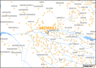
Wazīr Kili (North-West Frontier, Pakistan)Wazīr Kili is a town in the North-West Frontier region of Pakistan. An overview map of the region around Wazīr Kili is displayed below.
regional and 3d topo map of Wazīr Kili, Pakistan ::
Wazīr Kili airports ::
The nearest airport is PEW - Peshawar Intl, located 19.5 km south of Wazīr Kili.
Other airports nearby include JAA - Jalalabad (93.8 km west), SDT - Saidu Sharif (107.7 km north east), ISB - Islamabad Chaklala (161.9 km east), Nearby towns ::
Jahangirpura (0.2km north east) //
Bandai (0.4km south) //
Chargule Pāyan (0.5km north) //
Shaghāli Bāla (1.0km east) //
Zormandai Kili (1.3km north west) //
Piāri Bāla (1.3km north east) //
Kudai (1.7km north west) //
Sher Kili (2.1km south) //
Angūr Kili (2.2km north) //
Dheri Kili (2.0km south west) //
Piāri Pāyān (2.0km east) //
Shaghāli Pāyān (2.0km east) //
Raza Khān Kili (2.3km north west) //
Alo Kili (2.4km south west) //
Khat Kili (2.6km south) //
Shah Beg Kili (2.5km north east) //
Saddo Garhi (2.8km south) //
Miān Khel (2.5km south west) //
Mīr Bāgh Kili (2.8km north) //
Bela Mohmandān (2.5km north west) //
Zarīp Kor (2.7km north west) //
Turkai (2.6km east) //
Hakīm Khān (2.8km east) //
Sherdād Garhi (3.0km south west) //
Kudai (3.4km south east) //
Jugni (3.1km east) //
Ashai Kor (3.3km north west) //
Bar Kūchiān (3.6km south west) //
Sāhibzāda Kili (3.6km north east) //
[all distances 'as the bird flies' and approximate]  Places with similar names to Wazīr Kili, Pakistan ::
// Wazīr Kala (PK)
// Wazīr Kalle (PK)
Disclaimer :: Information on this page comes without warranty of any kind |
||
|
Where is Wazīr Kili? Elevation and coordinates ::
Latitude (lat): 34°10'2"N Longitude (lon): 71°28'40"E
Elevation (approx.): 334m (map arrows pan, magnifying glasses zoom) |
||
|
Visiting Wazīr Kili? Hotel/Accommodation ::
Book a hotel in Wazīr Kili Travel Guide ::
Buy a travel guide for Pakistan rental cars ::
car rental offers GPS waypoint ::
download a GPX waypoint (PoI) of Wazīr Kili for your GPS receiver
|
||