|
search place name
|
||
Araditos (Choluteca, Honduras)Araditos is a town in the Choluteca region of Honduras. An overview map of the region around Araditos is displayed below.
regional and 3d topo map of Araditos, Honduras ::

Araditos airports ::
The nearest airport is TGU - Tegucigalpa Toncontin Intl, located 64.3 km north of Araditos.
Other airports nearby include MGA - Managua Intl (182.7 km south east), SAL - San Salvador El Salvador Intl (206.4 km west), SAP - San Pedro Sula La Mesa Intl (233.3 km north), Nearby towns ::
Las Montoyas (0.0km north) //
Mariitas (0.0km north) //
El Portillo (0.0km north) //
Cerro Quebrado (0.0km north) //
El Jobo (1.9km south) //
Agua Blanca (1.8km west) //
La Jagua (1.8km west) //
Rinconada (1.8km east) //
Alianza (1.8km east) //
Las Trancas (2.2km north east) //
El Puerco (2.2km north west) //
Las Carretillas (2.6km north west) //
Las Guayabas (2.7km north) //
La Isleta (2.8km north west) //
Los Araditos (2.9km north) //
Las Chilcas (2.9km north west) //
Mata Palo (3.2km north) //
San José (3.2km north) //
Los Jícaros (3.5km north east) //
Santa Lucía (3.7km north west) //
Platanitos (4.1km south west) //
El Aguacate (4.1km south west) //
Yuculimay (4.1km south west) //
Las Isletas (4.1km south west) //
El Tablón (4.1km south east) //
Las Astas (4.1km north east) //
El Rodeíto (4.1km north west) //
Los Sánchez (4.3km north) //
Buena Vista (4.3km north) //
[all distances 'as the bird flies' and approximate] 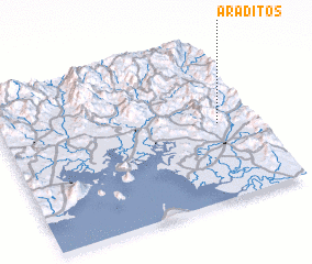 Places with similar names to Araditos, Honduras ::
Disclaimer :: Information on this page comes without warranty of any kind |
||
|
Where is Araditos? Elevation and coordinates ::
Latitude (lat): 13°29'0"N Longitude (lon): 87°9'0"W
Elevation (approx.): 723m (map arrows pan, magnifying glasses zoom) |
||
|
Visiting Araditos? Hotel/Accommodation ::
Book a hotel in Araditos Travel Guide ::
Buy a travel guide for Honduras rental cars ::
car rental offers GPS waypoint ::
download a GPX waypoint (PoI) of Araditos for your GPS receiver
|
||