|
search place name
|
||
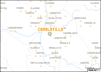
Camalotillo (Olancho, Honduras)Camalotillo is a town in the Olancho region of Honduras. An overview map of the region around Camalotillo is displayed below.
regional and 3d topo map of Camalotillo, Honduras ::
Camalotillo airports ::
The nearest airport is LCE - La Ceiba Goloson Intl, located 71.1 km north of Camalotillo.
Other airports nearby include TEA - Tela (100.5 km north west), TGU - Tegucigalpa Toncontin Intl (121.6 km south), SAP - San Pedro Sula La Mesa Intl (121.7 km west), RTB - Roatan Juan Manuel Galvez Intl (139.1 km north), Nearby towns ::
Mirajoco (3.7km north) //
Los Blancos (4.0km south east) //
Los Prietos (4.0km north east) //
Pantas (5.4km east) //
El Carrizal (5.8km south) //
El Terrero (5.8km south) //
El Guanacaste (5.8km south) //
Mangulilito (5.8km south) //
El Vallecito (5.8km north) //
Mangulile (6.5km south east) //
Alao (6.6km north west) //
Monte Verde (6.5km south west) //
El Naranjo (6.5km north west) //
Mirajoco (6.5km north west) //
Tierra Blanca (7.2km east) //
Silaca (7.6km south) //
Los Almácigos (7.6km south) //
Los Montes (7.6km north) //
El Chorro (7.6km south) //
Rincón Quemado (7.6km south) //
Julián (7.6km north) //
El Paso Real (7.6km north) //
El Águila (7.7km south west) //
El Cacao (8.2km south east) //
La Pandura (8.1km north west) //
Lomitas (8.2km south west) //
La Danta (8.2km south west) //
Tapiquil (8.2km north west) //
El Puente (8.2km north west) //
[all distances 'as the bird flies' and approximate]  Places with similar names to Camalotillo, Honduras ::
// Gomulat-Tala (RU)
// Kamélédala (BF)
// Gamalotal (CR)
// Gamalotillo (CR)
// Camalotal (GT)
// Camalotal (HN)
// Camalotal (HN)
// Camalotal (HN)
// Gamelotal (VE)
// Gamelotal (VE)
Disclaimer :: Information on this page comes without warranty of any kind |
||
|
Where is Camalotillo? Elevation and coordinates ::
Latitude (lat): 15°6'0"N Longitude (lon): 86°51'0"W
Elevation (approx.): 1095m (map arrows pan, magnifying glasses zoom) |
||
|
Visiting Camalotillo? Hotel/Accommodation ::
Book a hotel in Camalotillo Travel Guide ::
Buy a travel guide for Honduras rental cars ::
car rental offers GPS waypoint ::
download a GPX waypoint (PoI) of Camalotillo for your GPS receiver
|
||