|
search place name
|
||
Caulotales (Santa Bárbara, Honduras)Caulotales is a town in the Santa Bárbara region of Honduras. An overview map of the region around Caulotales is displayed below.
regional and 3d topo map of Caulotales, Honduras ::

Caulotales airports ::
The nearest airport is SAP - San Pedro Sula La Mesa Intl, located 85.0 km north east of Caulotales.
Other airports nearby include TEA - Tela (142.9 km north east), TGU - Tegucigalpa Toncontin Intl (149.5 km south east), SAL - San Salvador El Salvador Intl (169.4 km south west), LCE - La Ceiba Goloson Intl (192.2 km north east), Nearby towns ::
Nueva York (1.9km south) //
Las Marías (1.9km south) //
Los Dantos (1.8km east) //
El Palmo (2.6km north east) //
El Ocotillo (2.6km south east) //
Congolón (3.7km north) //
La Unión (3.6km west) //
Calanora (3.6km east) //
Las Quebradas (3.6km east) //
Brisas de Oro (4.1km north west) //
Zorca (4.1km north east) //
El Aguacate (4.1km south west) //
Las Quebradas (4.1km south west) //
Las Peñas (5.2km south west) //
El Sitio (5.2km south west) //
El Llano (5.4km east) //
Quebrada Desplayada (5.7km west) //
San Isidro (5.7km west) //
Nejapa (5.7km east) //
Tierra Colorada (6.5km north east) //
Loma del Ocotal (6.6km north west) //
El Níspero (6.6km south east) //
El Llano del Venado (6.5km south west) //
Candelaria (7.4km north) //
Los Hoyos (7.4km west) //
El Suital (7.4km west) //
Buena Vista (7.4km east) //
Yoro (7.6km south) //
Santa Cruz (7.6km south) //
[all distances 'as the bird flies' and approximate] 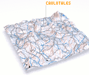 Places with similar names to Caulotales, Honduras ::
// Caldelas (PT)
// Caldelas (PT)
// Caldelas (PT)
// Caldelas (PT)
// Caldelas (ES)
// Caldelas (ES)
// Cladells (ES)
// Caulotales (GT)
// Caulotales (HN)
// Cailladelles (FR)
Disclaimer :: Information on this page comes without warranty of any kind |
||
|
Where is Caulotales? Elevation and coordinates ::
Latitude (lat): 14°49'0"N Longitude (lon): 88°22'0"W
Elevation (approx.): 1492m (map arrows pan, magnifying glasses zoom) |
||
|
Visiting Caulotales? Hotel/Accommodation ::
Book a hotel in Caulotales Travel Guide ::
Buy a travel guide for Honduras rental cars ::
car rental offers GPS waypoint ::
download a GPX waypoint (PoI) of Caulotales for your GPS receiver
|
||