|
search place name
|
||
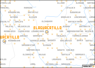
El Aguacatillo (Lempira, Honduras)El Aguacatillo is a town in the Lempira region of Honduras. An overview map of the region around El Aguacatillo is displayed below.
regional and 3d topo map of El Aguacatillo, Honduras ::
El Aguacatillo airports ::
The nearest airport is SAL - San Salvador El Salvador Intl, located 119.3 km south of El Aguacatillo.
Other airports nearby include SAP - San Pedro Sula La Mesa Intl (136.7 km north east), TGU - Tegucigalpa Toncontin Intl (162.2 km east), TEA - Tela (194.7 km north east), GUA - Guatemala City La Aurora (201.1 km west), Nearby towns ::
San Manuel de Colohete (0.0km north) //
Las Vegas (1.8km west) //
Río Grande (1.8km east) //
Santa Teresa (1.8km east) //
Chachate (1.8km east) //
San Lucas (1.9km south) //
La Miande (2.6km north west) //
San José (2.6km south west) //
Mocal (2.6km south west) //
El Ciprés (2.6km south west) //
El Encontradero (2.6km north west) //
San Antonio (2.6km north west) //
La Meande (2.6km north east) //
La Hacienda (2.6km north east) //
El Chiquirín (3.7km north) //
Los Horcones (3.6km west) //
El Horno (3.6km east) //
San Juan (3.6km east) //
Mocal (4.1km south west) //
Quesuca (4.1km south east) //
San Pedro (4.0km south west) //
Peña Blanca (4.0km south west) //
Guacutao (4.0km north east) //
Tierra Colorada (5.2km south west) //
Yuní (5.4km east) //
Fraternidad La Gloria (5.4km east) //
El Rodeo (5.6km south) //
Corante (5.8km south) //
Jicarillo (5.7km east) //
[all distances 'as the bird flies' and approximate] 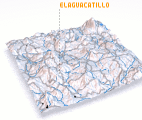 Places with similar names to El Aguacatillo, Honduras ::
// El Aguacatal (CO)
// El Aguacatal (MX)
// El Aguacatillo (MX)
// El Aguacatal (HN)
// El Aguacatal (HN)
// El Aguacatal (HN)
// El Aguacatal (HN)
// El Aguacatal (HN)
// El Aguacatillo (HN)
// El Aguacatillo (HN)
Disclaimer :: Information on this page comes without warranty of any kind |
||
|
Where is El Aguacatillo? Elevation and coordinates ::
Latitude (lat): 14°27'0"N Longitude (lon): 88°40'0"W
Elevation (approx.): 1677m (map arrows pan, magnifying glasses zoom) |
||
|
Visiting El Aguacatillo? Hotel/Accommodation ::
Book a hotel in El Aguacatillo Travel Guide ::
Buy a travel guide for Honduras rental cars ::
car rental offers GPS waypoint ::
download a GPX waypoint (PoI) of El Aguacatillo for your GPS receiver
|
||