|
search place name
|
||
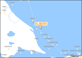
El Benk (Gracias a Dios, Honduras)El Benk is a town in the Gracias a Dios region of Honduras. An overview map of the region around El Benk is displayed below.
regional and 3d topo map of El Benk, Honduras ::
El Benk airports ::
The nearest airport is PUZ - Puerto Cabezas, located 116.7 km south of El Benk.
Other airports nearby include PVA - Providencia El Embrujo (286.1 km south east), Nearby towns ::
Karasunta (1.8km west) //
Titi (1.9km south) //
Tusidaksa (2.6km north west) //
Guam (2.6km north east) //
Yasibila (4.1km south east) //
Capri (4.1km south east) //
Raya (4.1km south east) //
El Faro (4.1km south east) //
Pakwí (5.2km north west) //
Locos (5.2km south east) //
Benk (5.8km south) //
Rayamura (6.6km south east) //
Clubquimuna (9.2km south east) //
Clubkí (9.2km south east) //
Casautara (10.3km south east) //
[all distances 'as the bird flies' and approximate] 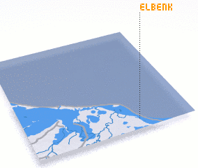 Places with similar names to El Benk, Honduras ::
Disclaimer :: Information on this page comes without warranty of any kind |
||
|
Where is El Benk? Elevation and coordinates ::
Latitude (lat): 15°6'0"N Longitude (lon): 83°19'0"W
Elevation (approx.): 6m (map arrows pan, magnifying glasses zoom) |
||
|
Visiting El Benk? Hotel/Accommodation ::
Book a hotel in El Benk Travel Guide ::
Buy a travel guide for Honduras rental cars ::
car rental offers GPS waypoint ::
download a GPX waypoint (PoI) of El Benk for your GPS receiver
|
||