|
search place name
|
||
El Ojo de Agua (Yoro, Honduras)El Ojo de Agua is a town in the Yoro region of Honduras. An overview map of the region around El Ojo de Agua is displayed below.
regional and 3d topo map of El Ojo de Agua, Honduras ::

El Ojo de Agua airports ::
The nearest airport is LCE - La Ceiba Goloson Intl, located 34.9 km north of El Ojo de Agua.
Other airports nearby include TEA - Tela (70.9 km north west), RTB - Roatan Juan Manuel Galvez Intl (106.5 km north east), SAP - San Pedro Sula La Mesa Intl (108.1 km west), TGU - Tegucigalpa Toncontin Intl (155.3 km south), Nearby towns ::
San Lorenzo Abajo (1.9km south) //
Los Horcones (1.8km east) //
Quebrada Grande (1.9km north) //
San Patricio (3.6km east) //
San Lorenzo (4.0km south west) //
El Aguacate (5.1km north west) //
Monte Obscuro (5.4km east) //
San Juan (5.4km east) //
San Marcos (5.7km west) //
La Cebadilla (7.1km west) //
Los Perritos (7.4km west) //
San Dimas (7.4km east) //
San Jacinto (7.7km south west) //
[all distances 'as the bird flies' and approximate] 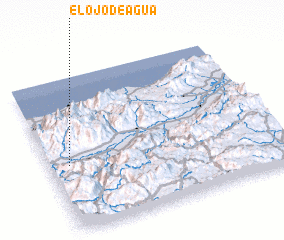 Places with similar names to El Ojo de Agua, Honduras ::
// El Ojo de Agua (PA)
// El Ojo de Agua (GT)
// El Ojo de Agua (MX)
// El Ojo de Agua (MX)
// El Ojo de Agua (MX)
// El Ojo de Agua (MX)
// El Ojo de Agua (MX)
// El Ojo de Agua (MX)
// El Ojo de Agua (MX)
// El Ojo de Agua (MX)
Disclaimer :: Information on this page comes without warranty of any kind |
||
|
Where is El Ojo de Agua? Elevation and coordinates ::
Latitude (lat): 15°26'0"N Longitude (lon): 86°55'0"W
Elevation (approx.): 298m (map arrows pan, magnifying glasses zoom) |
||
|
Visiting El Ojo de Agua? Hotel/Accommodation ::
Book a hotel in El Ojo de Agua Travel Guide ::
Buy a travel guide for Honduras rental cars ::
car rental offers GPS waypoint ::
download a GPX waypoint (PoI) of El Ojo de Agua for your GPS receiver
|
||