|
search place name
|
||
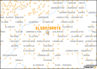
El Sonzapote (Choluteca, Honduras)El Sonzapote is a town in the Choluteca region of Honduras. An overview map of the region around El Sonzapote is displayed below.
regional and 3d topo map of El Sonzapote, Honduras ::
El Sonzapote airports ::
The nearest airport is TGU - Tegucigalpa Toncontin Intl, located 73.3 km north of El Sonzapote.
Other airports nearby include MGA - Managua Intl (169.1 km south east), Nearby towns ::
La Piñuela (0.0km north) //
Somuina (1.8km west) //
Los Zanjones (1.8km west) //
Las Lajas (1.8km west) //
El Quebracho (1.8km west) //
Porta Banco (1.8km west) //
El Arenal (1.8km east) //
La Lomilla (1.8km east) //
Las Pereras (1.8km west) //
Hoja de Puerco (1.8km east) //
Las Cañitas (2.6km south west) //
El Hondable (3.6km east) //
Los Limones (3.6km east) //
El Corrientón (3.6km west) //
La Pita (3.6km east) //
La Vega (3.6km west) //
El Limón (3.7km south) //
El Zapatón (3.7km north) //
Las Trojas (4.1km south east) //
La Poza (4.1km north west) //
El Aguacate (4.1km north west) //
Pueblo Nuevo (4.1km south west) //
El Terrero (4.1km south east) //
El Cerro (4.1km south east) //
Guayabillas (5.2km south west) //
Las Abejas (5.2km south east) //
Zanja de Palma (5.2km south east) //
El Chichimeco (5.2km north west) //
La Ciénega (5.2km north east) //
[all distances 'as the bird flies' and approximate] 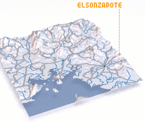 Places with similar names to El Sonzapote, Honduras ::
// El Zunzapote (HN)
Disclaimer :: Information on this page comes without warranty of any kind |
||
|
Where is El Sonzapote? Elevation and coordinates ::
Latitude (lat): 13°26'0"N Longitude (lon): 87°0'0"W
Elevation (approx.): 303m (map arrows pan, magnifying glasses zoom) |
||
|
Visiting El Sonzapote? Hotel/Accommodation ::
Book a hotel in El Sonzapote Travel Guide ::
Buy a travel guide for Honduras rental cars ::
car rental offers GPS waypoint ::
download a GPX waypoint (PoI) of El Sonzapote for your GPS receiver
|
||