|
search place name
|
||
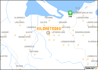
Kilómetro 13 (Atlántida, Honduras)Kilómetro 13 is a town in the Atlántida region of Honduras. An overview map of the region around Kilómetro 13 is displayed below.
regional and 3d topo map of Kilómetro 13, Honduras ::
Kilómetro 13 airports ::
The nearest airport is TEA - Tela, located 11.6 km north east of Kilómetro 13.
Other airports nearby include SAP - San Pedro Sula La Mesa Intl (48.5 km south west), LCE - La Ceiba Goloson Intl (74.8 km east), RTB - Roatan Juan Manuel Galvez Intl (129.4 km north east), TGU - Tegucigalpa Toncontin Intl (184.9 km south), Nearby towns ::
Kilómetro 15 (0.0km north) //
San Alejo (1.9km south) //
Kilómetro 10 (1.8km east) //
El Jute (2.6km south east) //
El Junco (2.6km north east) //
San José (2.6km south east) //
El Guano (2.6km south east) //
La Tarralosa (3.6km east) //
Culota (4.1km north west) //
Tornabé (5.6km north) //
Puerto Arturo (5.7km east) //
Laguna de Micos (5.7km west) //
La Esperanza (6.5km south east) //
San Juan (6.5km north east) //
Uluita (7.1km west) //
Las Quebradas (8.0km south east) //
Santiago (9.1km south west) //
Los Anices (9.0km south west) //
[all distances 'as the bird flies' and approximate] 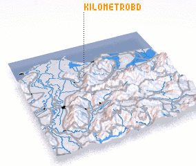 Places with similar names to Kilómetro 13, Honduras ::
// Kilómetro 130 (VE)
// Kilómetro 133 (VE)
Disclaimer :: Information on this page comes without warranty of any kind |
||
|
Where is Kilómetro 13? Elevation and coordinates ::
Latitude (lat): 15°42'0"N Longitude (lon): 87°33'0"W
Elevation (approx.): 195m (map arrows pan, magnifying glasses zoom) |
||
|
Visiting Kilómetro 13? Hotel/Accommodation ::
Book a hotel in Kilómetro 13 Travel Guide ::
Buy a travel guide for Honduras rental cars ::
car rental offers GPS waypoint ::
download a GPX waypoint (PoI) of Kilómetro 13 for your GPS receiver
|
||