|
search place name
|
||
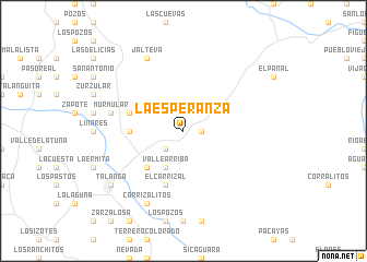
La Esperanza (Francisco Morazán, Honduras)La Esperanza is a town in the Francisco Morazán region of Honduras. An overview map of the region around La Esperanza is displayed below.
regional and 3d topo map of La Esperanza, Honduras ::
La Esperanza airports ::
The nearest airport is TGU - Tegucigalpa Toncontin Intl, located 48.2 km south west of La Esperanza.
Other airports nearby include LCE - La Ceiba Goloson Intl (144.1 km north), SAP - San Pedro Sula La Mesa Intl (147.7 km north west), TEA - Tela (154.8 km north), RTB - Roatan Juan Manuel Galvez Intl (213.3 km north), Nearby towns ::
Los Charcos (1.8km east) //
Palmira (2.6km south west) //
Valle Arriba (4.1km south west) //
El Rosario (5.2km south west) //
Barrio San José de Buena Vista (5.4km west) //
El Carrizal (5.8km south) //
La Ermita (5.7km west) //
Murmular (7.4km west) //
Carrizalitos (8.2km south west) //
Jalteva (8.2km north west) //
El Tablón (8.2km north west) //
Talanga (9.1km south west) //
[all distances 'as the bird flies' and approximate] 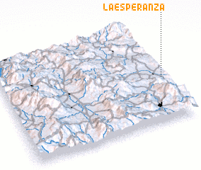 Places with similar names to La Esperanza, Honduras ::
// La Esperanza (PH)
// La Esperanza (PH)
// La Esperanza (PA)
// La Esperanza (PA)
// La Esperanza (PA)
// La Esperanza (PA)
// La Esperanza (PA)
// La Esperanza (CU)
// La Esperanza (CU)
// La Esperanza (CU)
Disclaimer :: Information on this page comes without warranty of any kind |
||
|
Where is La Esperanza? Elevation and coordinates ::
Latitude (lat): 14°27'0"N Longitude (lon): 87°1'0"W
Elevation (approx.): 980m (map arrows pan, magnifying glasses zoom) |
||
|
Visiting La Esperanza? Hotel/Accommodation ::
Book a hotel in La Esperanza Travel Guide ::
Buy a travel guide for Honduras rental cars ::
car rental offers GPS waypoint ::
download a GPX waypoint (PoI) of La Esperanza for your GPS receiver
|
||