|
search place name
|
||
La Junta (Ocotepeque, Honduras)La Junta is a town in the Ocotepeque region of Honduras. An overview map of the region around La Junta is displayed below.
regional and 3d topo map of La Junta, Honduras ::

La Junta airports ::
The nearest airport is SAL - San Salvador El Salvador Intl, located 119.6 km south of La Junta.
Other airports nearby include SAP - San Pedro Sula La Mesa Intl (151.4 km north east), GUA - Guatemala City La Aurora (170.2 km west), CBV - Coban (188.8 km north west), TGU - Tegucigalpa Toncontin Intl (193.6 km east), Nearby towns ::
San Antonio (1.8km west) //
San Francisco (3.6km east) //
Lucerna (4.1km north east) //
El Membrillo (4.0km south east) //
Sensenti (4.1km south east) //
Potrerillos (5.2km south east) //
Azacualpa (5.2km south east) //
San Francisco de Cones (5.4km east) //
La Cebadilla (5.7km east) //
La Concordia (5.8km north) //
Gualtaya (6.6km south east) //
Las Mesitas (6.5km south east) //
La Loma (6.5km south east) //
La Labor (6.5km south west) //
Agua Caliente (7.4km north) //
Santa Rosita (7.6km north) //
Paso La Vaca (7.4km east) //
Joya de Cones (7.4km east) //
Loma Casita (7.4km east) //
El Tablón (7.6km south) //
La Laguna (7.6km south) //
Cerro de Minas (8.1km north east) //
Los Mangos (8.1km north east) //
Santa Ifigenia (8.1km south west) //
Las Delicias (9.2km north west) //
La Calera (9.1km south east) //
El Zunzapote (9.1km north east) //
Llano Largo (9.1km south west) //
El Barro (9.1km north east) //
[all distances 'as the bird flies' and approximate] 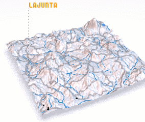 Places with similar names to La Junta, Honduras ::
// Laygenet (ET)
// La Junta (US)
// Legénd (HU)
// La Juanita (CU)
// La Juanita (CU)
// La Juanita (CU)
// La Juanita (CU)
// La Juanita (CU)
// La Juanita (CU)
// La Juanita (CU)
Disclaimer :: Information on this page comes without warranty of any kind |
||
|
Where is La Junta? Elevation and coordinates ::
Latitude (lat): 14°31'0"N Longitude (lon): 88°57'0"W
Elevation (approx.): 853m (map arrows pan, magnifying glasses zoom) |
||
|
Visiting La Junta? Hotel/Accommodation ::
Book a hotel in La Junta Travel Guide ::
Buy a travel guide for Honduras rental cars ::
car rental offers GPS waypoint ::
download a GPX waypoint (PoI) of La Junta for your GPS receiver
|
||