|
search place name
|
||
La Patastera (Francisco Morazán, Honduras)La Patastera is a town in the Francisco Morazán region of Honduras. An overview map of the region around La Patastera is displayed below.
regional and 3d topo map of La Patastera, Honduras ::

La Patastera airports ::
The nearest airport is TGU - Tegucigalpa Toncontin Intl, located 56.3 km south west of La Patastera.
Other airports nearby include LCE - La Ceiba Goloson Intl (152.3 km north), SAP - San Pedro Sula La Mesa Intl (170.4 km north west), TEA - Tela (172.0 km north west), RTB - Roatan Juan Manuel Galvez Intl (217.8 km north), Nearby towns ::
La Puerta (0.0km north) //
San Marcos (1.9km north) //
Casas Viejas (1.8km west) //
San Cristóbal (2.6km north east) //
Encuentros (4.0km north east) //
Morro Chele (4.1km north east) //
La Tumba (4.0km south west) //
Cerro Bonito (5.7km east) //
Aserradero (5.7km east) //
El Zarzal (5.7km east) //
Sanguijuela (5.7km east) //
La Laguna (7.4km east) //
La Vega del Riito (7.7km south east) //
Agua Fría (7.7km north west) //
El Higuero (8.2km south east) //
El Empedrado (8.2km south east) //
Santa Cruz (8.1km south east) //
Río Abajo (9.2km north west) //
Los Encinos (10.3km south east) //
[all distances 'as the bird flies' and approximate] 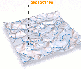 Places with similar names to La Patastera, Honduras :: Disclaimer :: Information on this page comes without warranty of any kind |
||
|
Where is La Patastera? Elevation and coordinates ::
Latitude (lat): 14°22'0"N Longitude (lon): 86°48'0"W
Elevation (approx.): 964m (map arrows pan, magnifying glasses zoom) |
||
|
Visiting La Patastera? Hotel/Accommodation ::
Book a hotel in La Patastera Travel Guide ::
Buy a travel guide for Honduras rental cars ::
car rental offers GPS waypoint ::
download a GPX waypoint (PoI) of La Patastera for your GPS receiver
|
||