|
search place name
|
||
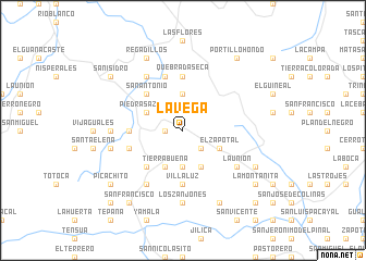
La Vega (Santa Bárbara, Honduras)La Vega is a town in the Santa Bárbara region of Honduras. An overview map of the region around La Vega is displayed below.
regional and 3d topo map of La Vega, Honduras ::
La Vega airports ::
The nearest airport is SAP - San Pedro Sula La Mesa Intl, located 64.4 km north east of La Vega.
Other airports nearby include TEA - Tela (124.2 km north east), TGU - Tegucigalpa Toncontin Intl (171.6 km south east), LCE - La Ceiba Goloson Intl (180.6 km north east), SAL - San Salvador El Salvador Intl (196.7 km south), Nearby towns ::
Los Gramales (1.8km west) //
El Terromote (1.8km west) //
San Juan (1.8km west) //
San Luis (2.6km south east) //
Posoma (3.7km south) //
Quebrada Obscura (3.7km north) //
Los Lagunatos (3.7km north) //
Tierra Buena (4.1km south west) //
Tembladera (4.1km south west) //
Piedras Azules (4.0km north west) //
La Peña (4.0km north west) //
Los Achiotes (4.0km north west) //
La Chorrera (4.1km south east) //
El Pinabete (4.0km south east) //
El Zapotal (4.0km south east) //
Azacualpa (5.2km south west) //
Calpules (5.2km south west) //
San Antonio (5.2km north west) //
Guaruma (5.2km north west) //
La Peñita (5.2km north west) //
La Golondrina (5.4km west) //
Cuchilla de Robles (5.6km south) //
Villa Luz (5.6km south) //
Cuchilla de la Danta (5.6km south) //
Quebrada Seca (5.6km north) //
Boquerones (5.6km north) //
El Zapotalito (5.8km north) //
Malcotal (5.7km west) //
El Chismis (5.7km west) //
[all distances 'as the bird flies' and approximate] 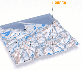 Places with similar names to La Vega, Honduras ::
Disclaimer :: Information on this page comes without warranty of any kind |
||
|
Where is La Vega? Elevation and coordinates ::
Latitude (lat): 15°6'0"N Longitude (lon): 88°24'0"W
Elevation (approx.): 1089m (map arrows pan, magnifying glasses zoom) |
||
|
Visiting La Vega? Hotel/Accommodation ::
Book a hotel in La Vega Travel Guide ::
Buy a travel guide for Honduras rental cars ::
car rental offers GPS waypoint ::
download a GPX waypoint (PoI) of La Vega for your GPS receiver
|
||