|
search place name
|
||
Los Catataos (Copán, Honduras)Los Catataos is a town in the Copán region of Honduras. An overview map of the region around Los Catataos is displayed below.
regional and 3d topo map of Los Catataos, Honduras ::

Los Catataos airports ::
The nearest airport is SAL - San Salvador El Salvador Intl, located 136.3 km south of Los Catataos.
Other airports nearby include SAP - San Pedro Sula La Mesa Intl (139.1 km north east), GUA - Guatemala City La Aurora (172.0 km west), CBV - Coban (181.6 km north west), TGU - Tegucigalpa Toncontin Intl (196.9 km east), Nearby towns ::
Arranca Barba (1.9km north) //
La Laguna (1.9km south) //
Zapote (1.8km west) //
El Trigo (1.8km west) //
Los Lesquines (2.6km north west) //
Portillo (2.6km north west) //
La Mina (2.6km north west) //
Supte Arriba (2.6km south west) //
Chivirilal (2.6km south west) //
La Unión (3.6km east) //
Cutal (3.7km north) //
Ojos de Agua (3.7km south) //
Carrizalito (4.0km north east) //
Palania (4.1km north east) //
El Corpus (4.1km north east) //
El Orégano (4.1km north east) //
Tejera (4.1km north west) //
Pashiapal (4.1km north west) //
El Panal (4.1km north west) //
El Junco (4.1km south west) //
El Zapotal (4.0km south west) //
Planerías (5.2km north west) //
La Calera (5.2km south west) //
El Moscarrón (5.8km south) //
El Sitio (5.8km south) //
Los Arroyos (5.7km east) //
Carrizal (5.8km north) //
San José de las Palmas (6.5km north east) //
El Pacayal (6.5km north west) //
[all distances 'as the bird flies' and approximate] 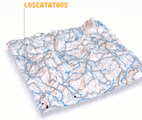 Places with similar names to Los Catataos, Honduras ::
// Las Aguaditas (CO)
// Las Aguaditas (CO)
// Los Cotudos (CO)
// Las Catitas (MX)
// Las Cuatitas (MX)
// Los Catetos (MX)
// Las Aguaditas (VE)
// Las Aguaditas (VE)
// Las Aguaditas (VE)
// Las Aguaditas (VE)
Disclaimer :: Information on this page comes without warranty of any kind |
||
|
Where is Los Catataos? Elevation and coordinates ::
Latitude (lat): 14°40'0"N Longitude (lon): 88°56'0"W
Elevation (approx.): 936m (map arrows pan, magnifying glasses zoom) |
||
|
Visiting Los Catataos? Hotel/Accommodation ::
Book a hotel in Los Catataos Travel Guide ::
Buy a travel guide for Honduras rental cars ::
car rental offers GPS waypoint ::
download a GPX waypoint (PoI) of Los Catataos for your GPS receiver
|
||