|
search place name
|
||
Los Chagüites (Francisco Morazán, Honduras)Los Chagüites is a town in the Francisco Morazán region of Honduras. An overview map of the region around Los Chagüites is displayed below.
regional and 3d topo map of Los Chagüites, Honduras ::

Los Chagüites airports ::
The nearest airport is TGU - Tegucigalpa Toncontin Intl, located 16.3 km north east of Los Chagüites.
Other airports nearby include SAP - San Pedro Sula La Mesa Intl (178.6 km north), SAL - San Salvador El Salvador Intl (196.4 km west), TEA - Tela (202.8 km north), LCE - La Ceiba Goloson Intl (204.5 km north), Nearby towns ::
Cofradía (1.8km west) //
Roble Cacho (1.9km north) //
Aragua (1.8km east) //
El Jícaro (1.8km east) //
Cerrito de Yaste (1.8km east) //
San Rafael (1.8km east) //
Pueblo Viejo (1.8km east) //
Las Mesitas (1.8km east) //
El Chaqüite (1.8km east) //
La Laguna (2.6km north west) //
Las Olominas (2.6km north west) //
El Encinal (2.6km south west) //
Güerisne (2.6km south west) //
El Cororo (2.6km south west) //
El Suyate (2.6km north west) //
Chocoarquín (2.6km north east) //
Río Abajo (2.6km north east) //
Gualiqueme (2.6km north east) //
El Zopilote (2.6km north east) //
Jiniguare (2.6km north east) //
Yucateca (2.6km south east) //
Sabana Redonda (2.6km south east) //
Media Legua (2.6km south east) //
Ojojona (2.6km south east) //
Suyatal (2.6km north east) //
Palo Seco (3.6km east) //
Iriguare (3.6km east) //
Las Horquetas (3.6km east) //
El Carrizal (4.1km south west) //
[all distances 'as the bird flies' and approximate] 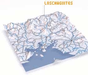 Places with similar names to Los Chagüites, Honduras ::
// Las Guaquitas (PA)
// Los Coquitos (CU)
// Los Coquitos (CU)
// Las Chiquitas (CO)
// Los Aguacates (CO)
// Los Coquitos (CO)
// Los Chagüites (SV)
// Los Chagüites (GT)
// Los Aguacates (MX)
// Los Aguacates (HN)
Disclaimer :: Information on this page comes without warranty of any kind |
||
|
Where is Los Chagüites? Elevation and coordinates ::
Latitude (lat): 13°57'0"N Longitude (lon): 87°19'0"W
Elevation (approx.): 1535m (map arrows pan, magnifying glasses zoom) |
||
|
Visiting Los Chagüites? Hotel/Accommodation ::
Book a hotel in Los Chagüites Travel Guide ::
Buy a travel guide for Honduras rental cars ::
car rental offers GPS waypoint ::
download a GPX waypoint (PoI) of Los Chagüites for your GPS receiver
|
||