|
search place name
|
||
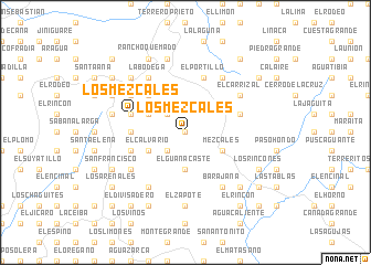
Los Mezcales (Francisco Morazán, Honduras)Los Mezcales is a town in the Francisco Morazán region of Honduras. An overview map of the region around Los Mezcales is displayed below.
regional and 3d topo map of Los Mezcales, Honduras ::
Los Mezcales airports ::
The nearest airport is TGU - Tegucigalpa Toncontin Intl, located 20.0 km north of Los Mezcales.
Other airports nearby include SAP - San Pedro Sula La Mesa Intl (191.1 km north west), SAL - San Salvador El Salvador Intl (208.4 km west), LCE - La Ceiba Goloson Intl (208.8 km north), TEA - Tela (211.8 km north), Nearby towns ::
El Ciruelo (0.0km north) //
La Ciénaga (2.6km south west) //
La Montaña de Izopo (2.6km north west) //
San Buenaventura (2.6km north west) //
El Guanacaste (3.7km south) //
Mezcales (4.0km south east) //
La Canoa (4.0km south west) //
El Calvario (4.0km south west) //
Los Noques (4.0km south west) //
El Peñón (4.0km south west) //
El Alto (4.0km south west) //
El Terrero (4.0km south west) //
Los Jimeritos (4.0km south west) //
Guayapito (4.0km south west) //
El Naranjo Agrio (4.0km south west) //
Cojutepeque (4.0km south west) //
El Portillo Grande (4.0km north west) //
El Sauce (5.2km north west) //
Milpa Grande (5.2km north west) //
El Locumupe (5.2km north west) //
Las Anonas (5.2km north west) //
Guayapito (5.4km west) //
El Suyatal (5.7km west) //
La Coyotera (5.7km west) //
Samalaco (5.7km west) //
La Crucita (5.8km north) //
El Portillo (5.8km north) //
Ojos de Agua (5.8km north) //
Portillo Grande (5.7km west) //
[all distances 'as the bird flies' and approximate] 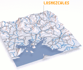 Places with similar names to Los Mezcales, Honduras ::
// Los Mezcales (GT)
// Los Mezcales (MX)
// Los Mezcales (MX)
// Los Mezcales (MX)
// Los Mezcales (MX)
// Los Mezcales (MX)
// Los Mezcales (MX)
// Los Mezcales (MX)
// Los Mescales (HN)
// Los Mezcales (HN)
Disclaimer :: Information on this page comes without warranty of any kind |
||
|
Where is Los Mezcales? Elevation and coordinates ::
Latitude (lat): 13°53'0"N Longitude (lon): 87°11'0"W
Elevation (approx.): 1003m (map arrows pan, magnifying glasses zoom) |
||
|
Visiting Los Mezcales? Hotel/Accommodation ::
Book a hotel in Los Mezcales Travel Guide ::
Buy a travel guide for Honduras rental cars ::
car rental offers GPS waypoint ::
download a GPX waypoint (PoI) of Los Mezcales for your GPS receiver
|
||