|
search place name
|
||
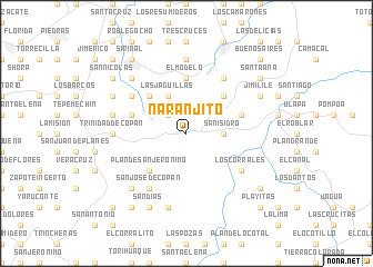
Naranjito (Santa Bárbara, Honduras)Naranjito is a town in the Santa Bárbara region of Honduras. An overview map of the region around Naranjito is displayed below.
regional and 3d topo map of Naranjito, Honduras ::
Naranjito airports ::
The nearest airport is SAP - San Pedro Sula La Mesa Intl, located 98.8 km north east of Naranjito.
Other airports nearby include TEA - Tela (158.6 km north east), SAL - San Salvador El Salvador Intl (171.7 km south), TGU - Tegucigalpa Toncontin Intl (186.2 km south east), CBV - Coban (193.9 km west), Nearby towns ::
El Almorzadero (2.6km north west) //
San Isidro (3.6km east) //
Las Jagüillas (4.1km north west) //
Lagunita (4.1km north west) //
El Peñasco (5.2km north east) //
El Tule (5.2km south west) //
Plan de San Jerónimo (5.2km south west) //
Buena Vista (5.2km south west) //
La Laguna (5.2km north west) //
El Modelo (5.6km north) //
Derrumbe (5.7km east) //
El Copante (5.7km west) //
Los Corrales (6.5km south east) //
El Chagüitón (6.5km north west) //
Las Crucitas (6.6km north east) //
Las Cuevas (6.5km north west) //
San José de Copán (6.6km south west) //
Trinidad de Copán (7.2km west) //
La Cueva del Plátano (7.4km north) //
La Gloria (7.4km west) //
Conal (7.6km south) //
Vivistorio (7.7km south west) //
El Porvenir (7.7km north west) //
Jimilile (8.1km north east) //
El Portillo (8.1km north west) //
Agua Caliente (8.1km north west) //
Sandías (8.2km south west) //
Corralitos (9.1km south east) //
Santa Ana (9.1km north east) //
[all distances 'as the bird flies' and approximate]  Places with similar names to Naranjito, Honduras ::
Disclaimer :: Information on this page comes without warranty of any kind |
||
|
Where is Naranjito? Elevation and coordinates ::
Latitude (lat): 14°57'0"N Longitude (lon): 88°41'0"W
Elevation (approx.): 921m (map arrows pan, magnifying glasses zoom) |
||
|
Visiting Naranjito? Hotel/Accommodation ::
Book a hotel in Naranjito Travel Guide ::
Buy a travel guide for Honduras rental cars ::
car rental offers GPS waypoint ::
download a GPX waypoint (PoI) of Naranjito for your GPS receiver
|
||