|
search place name
|
||
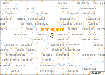
Río Chiquito (Francisco Morazán, Honduras)Río Chiquito is a town in the Francisco Morazán region of Honduras. An overview map of the region around Río Chiquito is displayed below.
regional and 3d topo map of Río Chiquito, Honduras ::
Río Chiquito airports ::
The nearest airport is TGU - Tegucigalpa Toncontin Intl, located 36.3 km north east of Río Chiquito.
Other airports nearby include SAL - San Salvador El Salvador Intl (186.3 km west), SAP - San Pedro Sula La Mesa Intl (196.0 km north), MGA - Managua Intl (221.9 km south east), LCE - La Ceiba Goloson Intl (225.5 km north), Nearby towns ::
Potrerillos (1.9km south) //
El Alto (1.8km east) //
Los Encuentros (2.6km north west) //
El Porvenir (2.6km south east) //
La Loma (2.6km south east) //
Las Mesas (3.6km west) //
Posolera (3.6km east) //
Monte Grande (3.7km south) //
San José (4.0km north west) //
El Llano (4.0km north west) //
Potrerillos (4.1km north east) //
Las Marías (4.1km south west) //
Las Casitas (4.0km south east) //
Agua Podrida (4.1km south east) //
Agua Fría (4.1km south east) //
El Capulín (5.2km north west) //
El Naranjal (5.2km north west) //
El Obrajito (5.2km north east) //
Lajas Galanas (5.2km north east) //
Opimuca (5.2km south east) //
Los Amates (5.2km south east) //
Las Pilas (5.2km south east) //
Las Mesas (5.4km west) //
La Tejera (5.4km east) //
La Enramada (5.7km east) //
El Zapote (5.7km west) //
Las Lajas (5.7km east) //
Buena Vista (5.7km east) //
La Montañita (5.7km west) //
[all distances 'as the bird flies' and approximate]  Places with similar names to Río Chiquito, Honduras ::
// Rio Chiquito (US)
// Río Chiquito (CO)
// Río Chiquito (CO)
// Río Chiquito (CR)
// Río Chiquito (SV)
// Río Chiquito (GT)
// Río Chiquito (GT)
// Río Chiquito (GT)
// Río Chiquito (MX)
// Río Chiquito (MX)
Disclaimer :: Information on this page comes without warranty of any kind |
||
|
Where is Río Chiquito? Elevation and coordinates ::
Latitude (lat): 13°46'0"N Longitude (lon): 87°22'0"W
Elevation (approx.): 198m (map arrows pan, magnifying glasses zoom) |
||
|
Visiting Río Chiquito? Hotel/Accommodation ::
Book a hotel in Río Chiquito Travel Guide ::
Buy a travel guide for Honduras rental cars ::
car rental offers GPS waypoint ::
download a GPX waypoint (PoI) of Río Chiquito for your GPS receiver
|
||