|
search place name
|
||
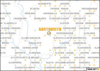
Santa Anita (Francisco Morazán, Honduras)Santa Anita is a town in the Francisco Morazán region of Honduras. An overview map of the region around Santa Anita is displayed below.
regional and 3d topo map of Santa Anita, Honduras ::
Santa Anita airports ::
The nearest airport is TGU - Tegucigalpa Toncontin Intl, located 25.8 km north east of Santa Anita.
Other airports nearby include SAP - San Pedro Sula La Mesa Intl (186.0 km north), SAL - San Salvador El Salvador Intl (190.5 km west), TEA - Tela (211.7 km north), LCE - La Ceiba Goloson Intl (214.3 km north), Nearby towns ::
La Montañita (0.0km north) //
El Sitio (0.0km north) //
Las Oficinas (0.0km north) //
Monte Grande (0.0km north) //
El Plomo (1.8km east) //
El Quebrachal (1.8km east) //
Huertas Viejas (1.8km east) //
Tierra Amarilla (1.8km east) //
Guasucarán (1.8km west) //
Las Galeras (2.6km south east) //
Santa Catarina (2.6km south east) //
Santa Cruz (4.0km south east) //
El Suyatillo (4.0km south east) //
Los Planes (4.0km south east) //
San Carlos (5.2km south west) //
Potrero Redondo (5.4km east) //
Guayabillas (5.4km east) //
Santiago (5.4km east) //
Guayabal (5.4km east) //
El Jícaro (5.4km east) //
Oreganito (5.6km south) //
Los Charcos (5.6km south) //
San Antonio (5.6km south) //
Cofradía (5.7km east) //
Sanjuanal (5.7km east) //
La Campana (5.7km west) //
La Pedrera (5.8km south) //
El Carrizal (5.8km north) //
Azacualpa (5.7km west) //
[all distances 'as the bird flies' and approximate]  Places with similar names to Santa Anita, Honduras ::
// Santa Anita (BR)
// Santa Anita (US)
// San Donato (IT)
// San Donato (IT)
// San Donato (IT)
// San Donato (IT)
// San Donato (IT)
// San Donato (IT)
// San Donato (IT)
// San Donato (IT)
Disclaimer :: Information on this page comes without warranty of any kind |
||
|
Where is Santa Anita? Elevation and coordinates ::
Latitude (lat): 13°52'0"N Longitude (lon): 87°21'0"W
Elevation (approx.): 959m (map arrows pan, magnifying glasses zoom) |
||
|
Visiting Santa Anita? Hotel/Accommodation ::
Book a hotel in Santa Anita Travel Guide ::
Buy a travel guide for Honduras rental cars ::
car rental offers GPS waypoint ::
download a GPX waypoint (PoI) of Santa Anita for your GPS receiver
|
||