|
search place name
|
||
Titoror (Copán, Honduras)Titoror is a town in the Copán region of Honduras. An overview map of the region around Titoror is displayed below.
regional and 3d topo map of Titoror, Honduras ::

Titoror airports ::
The nearest airport is SAP - San Pedro Sula La Mesa Intl, located 146.1 km north east of Titoror.
Other airports nearby include CBV - Coban (149.8 km north west), GUA - Guatemala City La Aurora (152.0 km west), SAL - San Salvador El Salvador Intl (159.9 km south), TEA - Tela (205.1 km north east), Nearby towns ::
Llanetillos (1.9km south) //
El Caliche (1.9km south) //
El Pinabete (1.9km south) //
El Quebracho (1.8km west) //
El Tigre (1.8km west) //
La Cutilca (2.6km south west) //
El Carrizalito (2.6km south west) //
Sesesmil Primero (2.6km north west) //
Concepción (2.6km north east) //
El Sompopero (3.6km west) //
Las Queseras (3.6km east) //
Sesesmil Segundo (3.7km north) //
Llano Grande (4.0km south west) //
La Cumbre de la Quesera (4.0km south east) //
Tierra Fría (4.0km south east) //
Lancetillal (4.0km north east) //
Aldea Nueva (4.1km north east) //
Corralito (5.2km south west) //
El Pito (5.2km south east) //
Buena Vista (5.2km south east) //
La Pintada (5.2km south east) //
El Bonete (5.2km south east) //
Tarral (5.2km north west) //
Plan del Ángel (5.2km north east) //
Agua Fría (5.4km west) //
El Cortés (5.6km north) //
Copán (5.6km south) //
Miramundo (5.4km east) //
Planes (5.4km east) //
[all distances 'as the bird flies' and approximate] 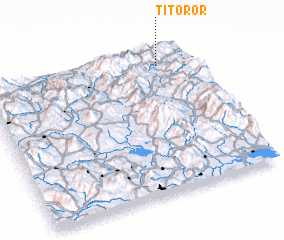 Places with similar names to Titoror, Honduras ::
// Détrier (FR)
Disclaimer :: Information on this page comes without warranty of any kind |
||
|
Where is Titoror? Elevation and coordinates ::
Latitude (lat): 14°53'0"N Longitude (lon): 89°9'0"W
Elevation (approx.): 1050m (map arrows pan, magnifying glasses zoom) |
||
|
Visiting Titoror? Hotel/Accommodation ::
Book a hotel in Titoror Travel Guide ::
Buy a travel guide for Honduras rental cars ::
car rental offers GPS waypoint ::
download a GPX waypoint (PoI) of Titoror for your GPS receiver
|
||