|
search place name
|
||
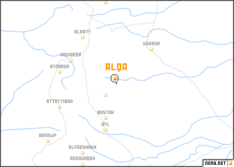
Al Qā‘ (Jordan)Al Qā‘ is a town in Jordan. An overview map of the region around Al Qā‘ is displayed below.
regional and 3d topo map of Al Qā‘, Jordan ::
Al Qā‘ airports ::
The nearest airport is VDA - Ovda, located 70.4 km south west of Al Qā‘.
Other airports nearby include AQJ - Aqaba King Hussein Intl (90.5 km south west), ETH - Elat Eilat (98.2 km south west), BEV - Beer-sheba Teyman (136.6 km north west), AMM - Amman Queen Alia Intl (165.1 km north), Nearby towns ::
 Places with similar names to Al Qā‘, Jordan ::
Disclaimer :: Information on this page comes without warranty of any kind |
||
|
Where is Al Qā‘? Elevation and coordinates ::
Latitude (lat): 30°17'0"N Longitude (lon): 35°33'0"E
Elevation (approx.): 1428m (map arrows pan, magnifying glasses zoom) |
||
|
Visiting Al Qā‘? Hotel/Accommodation ::
Book a hotel in Al Qā‘ Travel Guide ::
Buy a travel guide for Jordan rental cars ::
car rental offers GPS waypoint ::
download a GPX waypoint (PoI) of Al Qā‘ for your GPS receiver
|
||