|
search place name
|
||
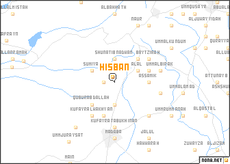
Ḩisbān (Jordan)Ḩisbān is a town in Jordan. An overview map of the region around Ḩisbān is displayed below.
regional and 3d topo map of Ḩisbān, Jordan ::
Ḩisbān airports ::
The nearest airport is AMM - Amman Queen Alia Intl, located 20.2 km south east of Ḩisbān.
Other airports nearby include ADJ - Amman Marka Intl (26.4 km north east), OMF - Mafraq King Hussein (75.4 km north east), TLV - Tel-aviv Ben Gurion (89.5 km west), SDV - Tel-aviv Sde Dov (102.3 km west), Nearby towns ::
Al Mushaqqar (1.6km west) //
Shūnat Ibn ‘Adwān (3.7km north) //
Juraynah (3.7km south) //
Sūmiyā (3.7km north west) //
Al ‘Āl (3.7km north east) //
Qubūr ‘Abd Allāh (4.9km south west) //
Umm al Qanāfidh (4.9km north east) //
Biddīn (4.9km north east) //
As Sāmik (4.7km east) //
Kufayr Abū Sarbūţ (5.8km south) //
Al Ḩawwāsīyah (5.1km east) //
Kufayr al Wakhyān (6.4km south west) //
Bayt Zir‘ah (6.0km north east) //
Kufayrāt Abū Khīnan (7.4km south) //
Umm al Ḩanāfīsh (6.6km east) //
Umm al Birak (6.6km east) //
Barāzīn (6.6km east) //
Manjā (7.3km south east) //
Al Quwayjīyah (9.2km south west) //
[all distances 'as the bird flies' and approximate] 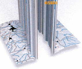 Places with similar names to Ḩisbān, Jordan ::
// Heesbeen (NL)
Disclaimer :: Information on this page comes without warranty of any kind |
||
|
Where is Ḩisbān? Elevation and coordinates ::
Latitude (lat): 31°48'0"N Longitude (lon): 35°48'0"E
Elevation (approx.): 807m (map arrows pan, magnifying glasses zoom) |
||
|
Visiting Ḩisbān? Hotel/Accommodation ::
Book a hotel in Ḩisbān Travel Guide ::
Buy a travel guide for Jordan rental cars ::
car rental offers GPS waypoint ::
download a GPX waypoint (PoI) of Ḩisbān for your GPS receiver
|
||