|
search place name
|
||
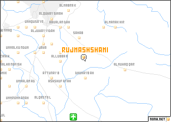
Rujm ash Shāmī (Jordan)Rujm ash Shāmī is a town in Jordan. An overview map of the region around Rujm ash Shāmī is displayed below.
regional and 3d topo map of Rujm ash Shāmī, Jordan ::
Rujm ash Shāmī airports ::
The nearest airport is AMM - Amman Queen Alia Intl, located 12.5 km south of Rujm ash Shāmī.
Other airports nearby include ADJ - Amman Marka Intl (15.6 km north), OMF - Mafraq King Hussein (62.4 km north), TLV - Tel-aviv Ben Gurion (108.7 km west), SDV - Tel-aviv Sde Dov (120.8 km west), Nearby towns ::
Dhuhaybah (3.7km south) //
Saḩāb (5.2km north) //
Al Lubban (4.7km west) //
Qurayyat Sālim (5.1km west) //
Ash Shufatah (7.3km south west) //
Aţ Ţunayb (7.3km south west) //
Qurayyat Nāfi‘ (7.3km north west) //
Ar Rajīb (8.1km north west) //
Al Mushayrifah (8.2km north east) //
Al Muwaqqar (7.6km east) //
Abū ‘Alandah (8.8km north west) //
Al Manākhir (9.2km north east) //
[all distances 'as the bird flies' and approximate]  Places with similar names to Rujm ash Shāmī, Jordan :: Disclaimer :: Information on this page comes without warranty of any kind |
||
|
Where is Rujm ash Shāmī? Elevation and coordinates ::
Latitude (lat): 31°50'0"N Longitude (lon): 36°1'0"E
Elevation (approx.): 784m (map arrows pan, magnifying glasses zoom) |
||
|
Visiting Rujm ash Shāmī? Hotel/Accommodation ::
Book a hotel in Rujm ash Shāmī Travel Guide ::
Buy a travel guide for Jordan rental cars ::
car rental offers GPS waypoint ::
download a GPX waypoint (PoI) of Rujm ash Shāmī for your GPS receiver
|
||